MANILA, Philippines — Tropical Cyclone Wind Signal (TCWS) No. 2 remained hoisted in parts of northern Luzon Tuesday morning as Tropical Storm Enteng cut across the region toward China.
Based on the 8 a.m. report of the Philippine Atmospheric, Geophysical and Astronomical Services Administration (Pagasa), the center of Enteng was last located over the coastal waters of Laoag City, Ilocos Norte, packing maximum sustained winds of 75 kilometers per hour (kph) near the center and gustiness of up to 115 kph.
Winds of greater than 62 kph and up to 88 kph may be expected for at least 24 hours in the below enumerated six areas that were still placed under TCWS No. 2:
- Ilocos Norte
- The northern portion of Ilocos Sur (Sinait, Cabugao, San Juan, Magsingal, Santo Domingo, San Ildefonso, San Vicente, Santa Catalina, City of Vigan, Bantay, Santa, Caoayan)
- Apayao
- Abra
- The northern and western portions of Kalinga (Balbalan, Pinukpuk, Lubuagan, Pasil)
- The western portion of mainland Cagayan (Piat, Santo Niño, Camalaniugan, Tuao, Pamplona, Rizal, Claveria, Lasam, Aparri, Ballesteros, Abulug, Allacapan, Sanchez-Mira, Santa Praxedes), including Babuyan Islands (Dalupiri Island and Fuga Island)
These areas may suffer minor to moderate impacts on life and property after the tropical storm.
READ: 13 dead as storm Enteng causes slides, flooding
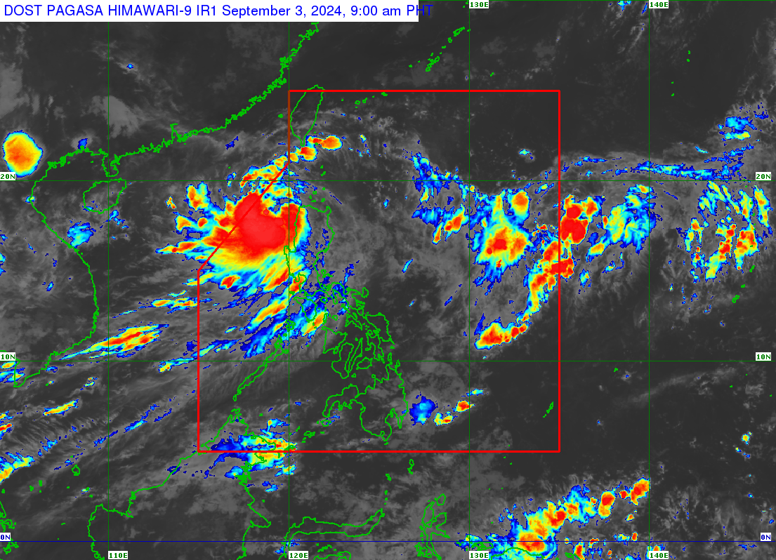
Weather satellite image from Pagasa
Meanwhile, 11 areas in northern Luzon stayed under TCWS No. 1 as wind speeds between 39 and 61 kph, which may result in minimal to minor threat to life and property, were expected to occur. These areas were:
- The rest of Ilocos Sur
- The northern portion of La Union (Luna, Santol, San Juan, Bagulin, Bangar, San Gabriel, Bacnotan, Sudipen, Balaoan, City of San Fernando)
- The rest of Kalinga
- Mountain Province
- Ifugao
- The northern portion of Benguet (Mankayan, Kapangan, Atok, Kabayan, Kibungan, Bakun, Buguias)
- Batanes
- The rest of Mainland Cagayan
- The rest of the Babuyan Islands
- The northern and western portions of Isabela (Divilacan, Santo Tomas, Alicia, San Mateo, Aurora, Santa Maria, Quezon, Ramon, Naguilian, Roxas, Luna, Delfin Albano, City of Cauayan, San Pablo, Ilagan City, Angadanan, Benito Soliven, City of Santiago, Tumauini, Cabagan, Reina Mercedes, San Manuel, Cabatuan, Quirino, Gamu, San Isidro, Mallig, Cordon, Maconacon, Burgos)
- The northern portion of Nueva Vizcaya (Ambaguio, Bagabag, Villaverde, Diadi, Solano)
Pagasa said Enteng was forecast to reach the severe tropical storm category by Tuesday afternoon or evening and exit the Philippine area of responsibility on Wednesday. It was likewise predicted to develop into a typhoon by Thursday, September 5.
READ: At least 800 still stranded at Luzon, Visayas ports due to Enteng
Pagasa added that Enteng was likewise seen to continue moving generally west-northwestward over the next 24 hours and then turn westward over the West Philippine Sea starting September 4 until it reaches Hainan, China, on Saturday, September 7.
Enteng is the fifth typhoon to hit the Philippines this year. It brought strong winds and rains in most parts of Luzon, including Metro Manila, tearing off roofs, uprooting trees, toppling concrete electric posts, and turning streets into rivers in several parts of the region.
The landslides and flooding it caused left at least 13 people dead, based on initial reports from national and local disaster response agencies.