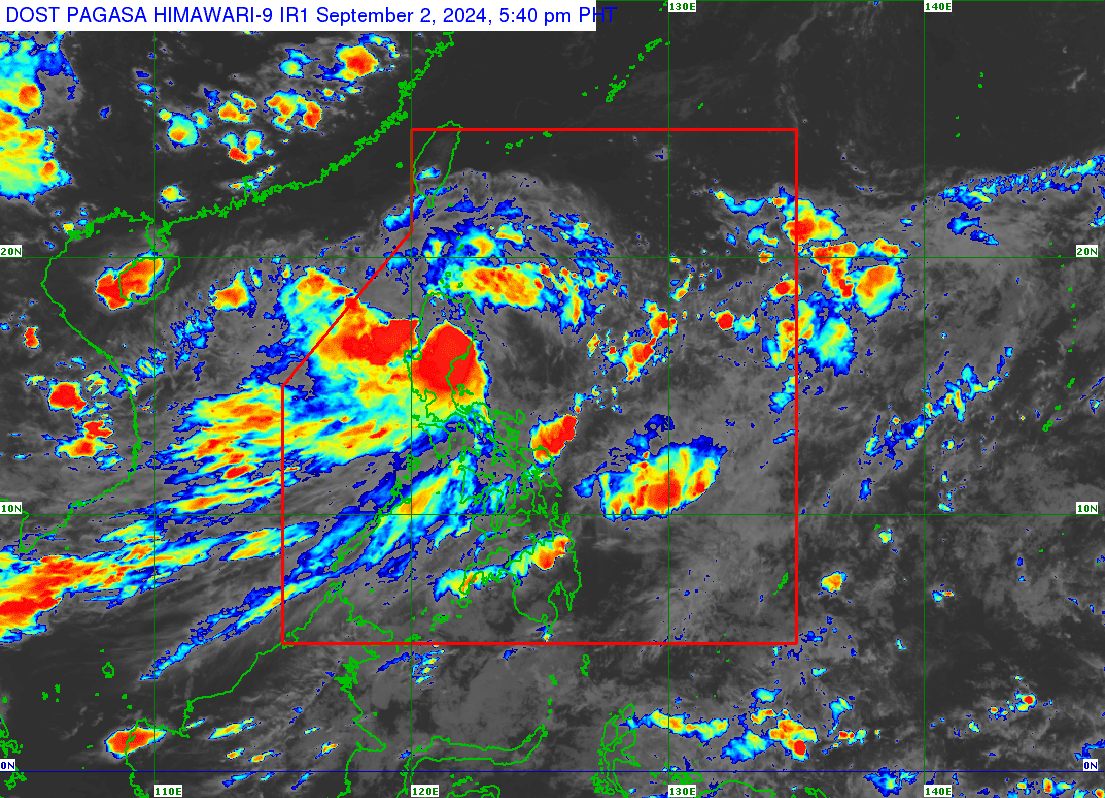
Tropical Storm Enteng pounds Quirino after landfall over Aurora

Tropical Storm Enteng (Photo from the Philippine Atmospheric, Geophysical and Astronomical Services Administration)
MANILA, Philippines — Tropical Storm Enteng (international name: Yagi) lashed Quirino province after it made landfall over Casiguran, Aurora, the state weather bureau said on Monday afternoon.
In its 5 p.m. update, the Philippine Atmospheric, Geophysical and Astronomical Services Administration (Pagasa) said Enteng was moving 20 kilometers per hour (kph), packing maximum sustained winds of 85 kph and gusts of up to 140 kph.
READ: Enteng makes landfall over Casiguran, Aurora – Pagasa

For Tuesday, the tropical storm is expected to move over Cagayan Valley or northern Cordillera Administrative Region before turning west-northwestward over the Babuyan Channel, Pagasa said.
It is forecast to leave the Philippine Area of Responsibility by Wednesday, Sept. 4.
Meanwhile, the following areas remain under wind signals:
Tropical Cyclone Wind Signal (TCWS) Number 2
- Ilocos Norte
- Apayao
- The eastern portion of Kalinga (Rizal, Pinukpuk, City of Tabuk)
- Cagayan including Babuyan Islands
- Isabela
- Quirino
- The northern portion of Aurora (Casiguran, Dilasag, Dinalungan, Dipaculao, Baler)
TCWS No. 1
- Batanes
- Ilocos Sur
- La Union
- The eastern portion of Pangasinan (Rosales, Asingan, Binalonan, Sison, San Manuel, Santa Maria, Balungao, San Quintin, Tayug, Umingan, Natividad, San Nicolas)
- Abra
- The rest of Kalinga
- Mountain Province
- Ifugao
- Benguet
- Nueva Vizcaya
- The rest of Aurora
- Nueva Ecija
- The eastern portion of Bulacan (Doña Remedios Trinidad, Norzagaray, City of San Jose del Monte, Obando, City of Meycauayan, Bocaue, Balagtas, Bustos, Baliuag, Pandi, Santa Maria, Marilao, Angat, San Rafael, San Ildefonso, San Miguel)
- Metro Manila
- Rizal
- The northeastern portion of Laguna (Santa Maria, Mabitac, Pakil, Pangil, Famy, Siniloan)
- The northern portion of Quezon (General Nakar, Infanta, Real) including Polillo Islands
The following areas are expected to experience rains from Monday until Tuesday afternoon:
- 100-200 (millimeters) mm: Ilocos Region, Nueva Vizcaya, Quirino, Isabela, Apayao, Abra, Benguet, and the northern and central portions of Aurora.
- 50-100 mm: Zambales, Bataan, Nueva Ecija, Bulacan, Rizal, Metro Manila, and the rest of Cagayan Valley, Cordillera Administrative Region, and Ilocos Region.
Tuesday afternoon to Wednesday afternoon
- 100-200 mm: Ilocos Sur and Abra
- 50-100 mm: The rest of Ilocos Region, and Benguet