
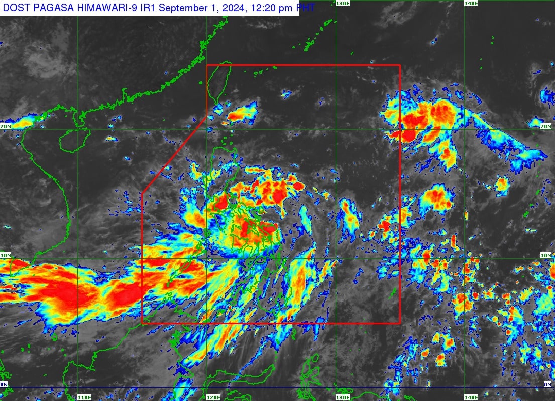
The Philippine Atmospheric, Geophysical and Astronomical Services Administration says tropical depression Enteng was last seen 150 kilometers east of Caterman, Northern Samar as of 10 a.m. on Sunday, September 1, 2024. (Satellite photo courtesy of Pagasa)
LIVE UPDATES: Tropical Depression Enteng
MANILA, Philippines — Eleven areas in the country have been placed under Tropical Cyclone Wind Signal (TCWS) No. 1 due to tropical depression Enteng, the Philippine Atmospheric, Geophysical and Astronomical Services Administration (Pagasa) said.

Below is the list of areas under TCWS No. 1 based on Pagasa’s 11 a.m. update:
- The eastern portion of Camarines Sur (Presentacion, Garchitorena, Caramoan, Calabanga, Naga City, Pili, Bombon, Magarao, Ocampo, Baao, Nabua, Bula, Balatan, Bato, Milaor, Minalabac, Camaligan, Saglay, Iriga City, Buhi, Tigaon, San Jose, Goa, Siruma, Tinambac, Lagonoy, Canaman, Gainza, San Fernando)
- Catanduanes
- Albay
- Sorsogon
- Burias Island
- Ticao Island
- Northern Samar
- Samar
- Eastern Samar
- Biliran
- Northeastern portion of Leyte (Babatngon, San Miguel, Tacloban City, Alangalang, Santa Fe, Palo, Barugo)
In a press briefing, Pagasa weather specialist Veronica Torres said Enteng was spotted 150 kilometers east of Caterman, Northern Samar as of 10 a.m.
It packs maximum sustained winds of 45 km per hour (kph) with gustiness of up to 55 kph.
She added that Enteng is moving in a northwestward direction at a speed of 30 kph.
READ: LPA east of Eastern Visayas has become tropical depression Enteng
Rainfall is generally higher in elevated or mountainous areas, which may result in flooding and rain-induced landslides, Torres warned.
She added that Enteng’s passage and landfall over Bicol Region-Eastern Visayas area is not ruled out within the next 48 hours.
It may also reach a typhoon category on Monday, September 2.
Meanwhile, Metro Manila may also experience rains brought by the southwest monsoon, locally termed “habagat.”
Furthermore, two to three typhoons may still be expected in the whole month of September.