
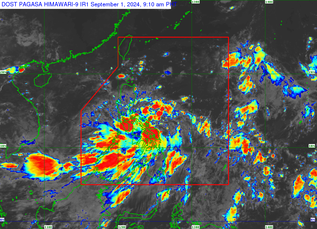
The Philippine Atmospheric, Geophysical and Astronomical Services Administration says the low pressure area located east of Eastern Visayas has developed into a tropical depression as of 8 a.m. on September 1, 2024. It has been named Enteng . (Satellite photo courtesy of PAGASA)
MANILA, Philippines — The low pressure area (LPA) located east of Eastern Visayas has developed into tropical depression Enteng, the Philippine Atmospheric, Geophysical and Astronomical Services Administration (Pagasa) said.
This development was based on the state weather bureau’s update as of 8 a.m. on Sunday.
There were no further details on the latest location of Enteng but based on Pagasa’s 4 a.m. bulletin, the tropical depression, which was just an LPA at that time, was last seen 175 kilometers (km) east-northeast of Guiuan, Eastern Samar, or 205 km east of Borongan City, Eastern Samar.
Pagasa said Masbate, Sorsogon, Northern Samar, Samar, Eastern Samar and Biliran will experience cloudy skies with scattered to widespread rains and thunderstorms because of this weather system.

READ: LPA east of Butuan City may develop into tropical depression
It will also bring overcast skies with scattered rains and thunderstorms over Caraga, Davao Region, Northern Mindanao, Quezon and the rest of Eastern Visayas, Central Visayas, and Bicol Region.
“Samantala, ang southwest monsoon o habagat naman ay umiiral pa rin dito sa kanlurang bahagi ng Southern Luzon, Visayas at Mindanao,” said Pagasa weather specialist Grace Castañeda.
(Meanwhile, the southwest monsoon or habagat is still prevailing over the western part of Southern Luzon, Visayas and Mindanao.)
She added habagat will bring scattered rains in the affected areas.
Metro Manila and the rest of Luzon, on the other hand, may expect partly cloudy to cloudy skies with isolated rain showers or thunderstorms because of localized thunderstorms.
As for predicted temperature ranges in key cities and areas of the country for September 1 (Sunday), Pagasa issued the following information:
Metro Manila: 26 to 33 °C
Baguio City: 18 to 25 °C
Laoag City: 26 to 33 °C
Tuguegarao: 27 to 35 °C
Puerto Princesa City: 25 to 31 °C
Tagaytay: 24 to 31 °C
Kalayaan Islands: 25 to 31 °C
Iloilo City: 25 to 32 °C
Cebu: 25 to 31 °C
Tacloban City: 24 to 32 °C
Cagayan de Oro City: 26 to 30 °C
Zamboanga City: 26 to 31 °C
Davao City: 27 to 31 °C
No gale warning alerts are raised in any part of the country’s seaboards.