
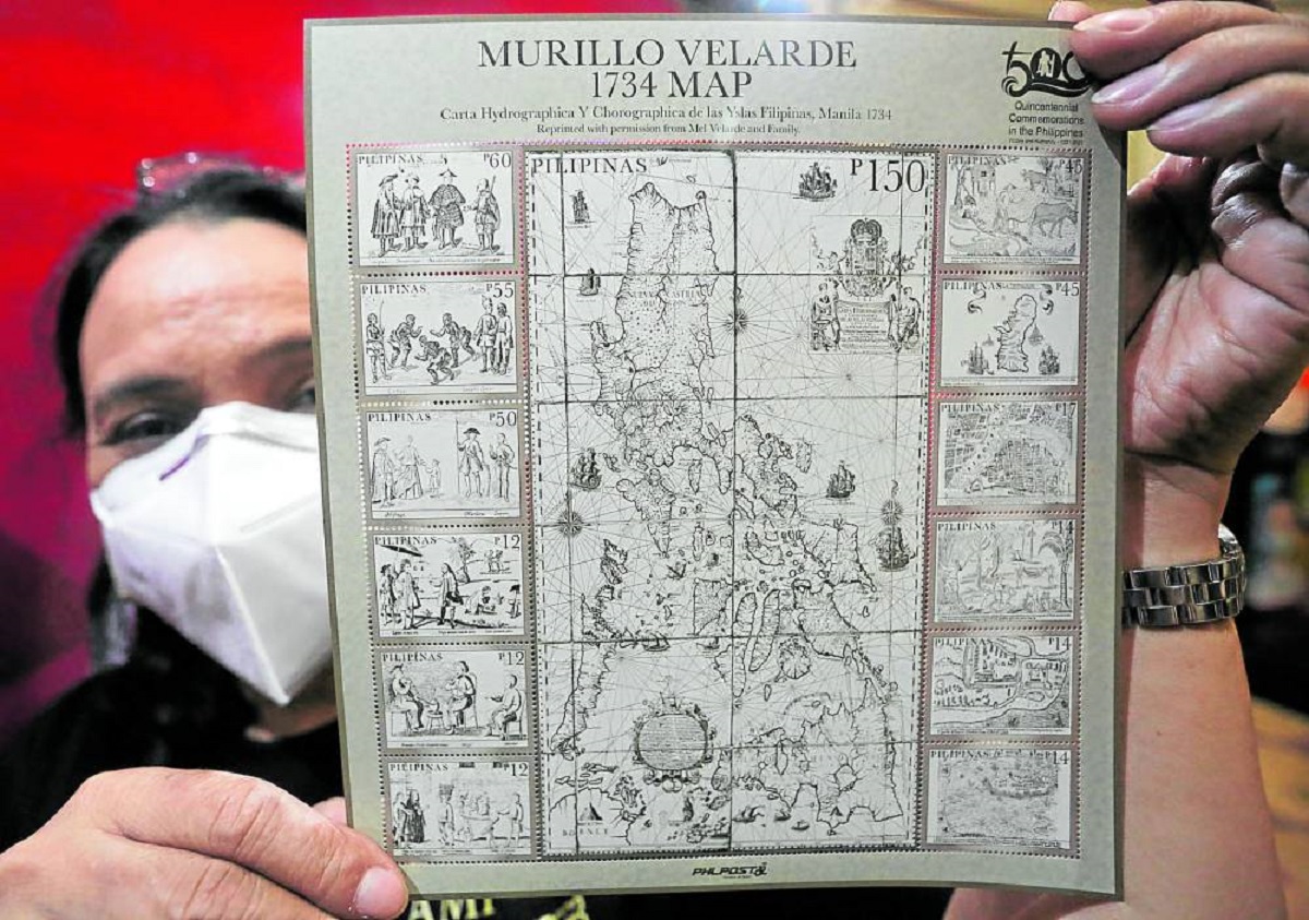
STAMP OF HERITAGE The Philippine Postal Corp. in 2021 releases stamps measuring 200 by 220 millimeters which depict the 1734 Murillo Velarde map. —Marianne Bermudez
MANILA, Philippines — The “mother of all Philippine maps,” which played a key role in the country’s landmark arbitral victory over China, has found a permanent home at the National Library of the Philippines (NLP) and will soon be available for free public viewing. The original Murillo Velarde 1734 map—the first scientific map of the Philippines—will be featured in the NLP’s Permanent Gallery, which was inaugurated on Friday.
NLP Director Cesar Gilbert Adriano said the Library aims to open this gallery to the public by September, after years of budget deliberations, bidding and other procedures which in turn were delayed by the 2020 pandemic.
READ: The 1734 Murillo Velarde Map
Published in Manila in 1734, the “Carta Hydrographica y Chorographica de las Islas Filipinas”—translated in the Cultural Center of the Philippines’ website as the “Aquatic and Regional Map of the Philippine Islands”—was drawn by Francisco Suarez and engraved on copper by Nicolas de la Cruz Bagay.
The two artists were tapped by Pedro Murillo Velarde of the Jesuit order after the Spanish government had tasked the friar to come up with an accurate map of the archipelago and its surrounding waters.
The map, measuring 111 by 119 centimeters, would go to other hands with the passage of time. Eventually it would be among the 80 possessions of the Duke of Northumberland (Ralph George Algernon Percy is currently the 12th duke) that were auctioned by Sotheby’s in London on Nov. 4, 2014.
Retired Supreme Court Associate Justice Antonio Carpio had informed various museums and individuals about the “mother of all Philippine maps,” as this artifact is now popularly called among historians.
From auction to arbitral court
Among the people whom Carpio talked to was Filipino technology entrepreneur and educator Mel Velasco Velarde, who eventually joined the London auction and prevailed over the other bidders with an offer of 170,500 pounds—or approximately P12 million at that time.
Velarde (no relation to the friar) had also convinced the British government that the map was not a piece of British heritage.
On Saturday, Carpio said the Philippines used the Murillo Velarde map in support of its arbitral case against China.
Irrefutable proof
Manila filed its arbitral case in 2013 before the Permanent Court of Arbitration in The Hague, after Beijing’s occupation of Scarborough Shoal following a standoff the previous year. The case led to the Philippines’ arbitral victory on July 12, 2016.
Velarde, who also chairs the Asian Institute of Journalism and Communication, had said in an earlier interview that the most valuable feature of the map is on the upper left section, west of the coastline of Luzon—the cluster of landmass called “Bajo de Masinloc” and “Panacot,” or what is now known as Panatag or Scarborough Shoal.
This was irrefutable proof that as early as the 1700s, the disputed shoal was already deemed part of the Philippine archipelago.
On April 21, 2017, about a year after The Hague ruling, Velarde donated the map through a deed signed with the Office of the Solicitor General.
‘Gift to the Filipino people’
“As my gift to the Filipino people, this 300-year-old Murillo Velarde 1734 Map is a declaration of my gratitude for the privilege of being a Filipino, blessed with a sovereign, democratic, and free homeland,” Velarde said.
“Let this be a beacon of our shared history and an inspiration for generations to come.”
The map also had another copy which León Gallery auctioned in 2019 for P46.7 million.
Velarde has also been donating replicas to government agencies, academic institutions and other public and private organizations.
He did this to raise public awareness about the map’s historical and cultural importance.
Adriano agreed, saying the map’s “journey stands as a testament to dedication and perseverance, bringing a significant cultural treasure to the forefront of public access and fulfilling the intent of Mr. Mel Velarde and the Philippine government to preserve and showcase the nation’s rich cultural heritage.”