Carina weakens; continues to enhance habagat – Pagasa
MANILA, Philippines — Carina has weakened and was reclassified as a typhoon-category cyclone although it is still expected to intensify the southwest monsoon or habagat, state meteorologists said on Wednesday night.
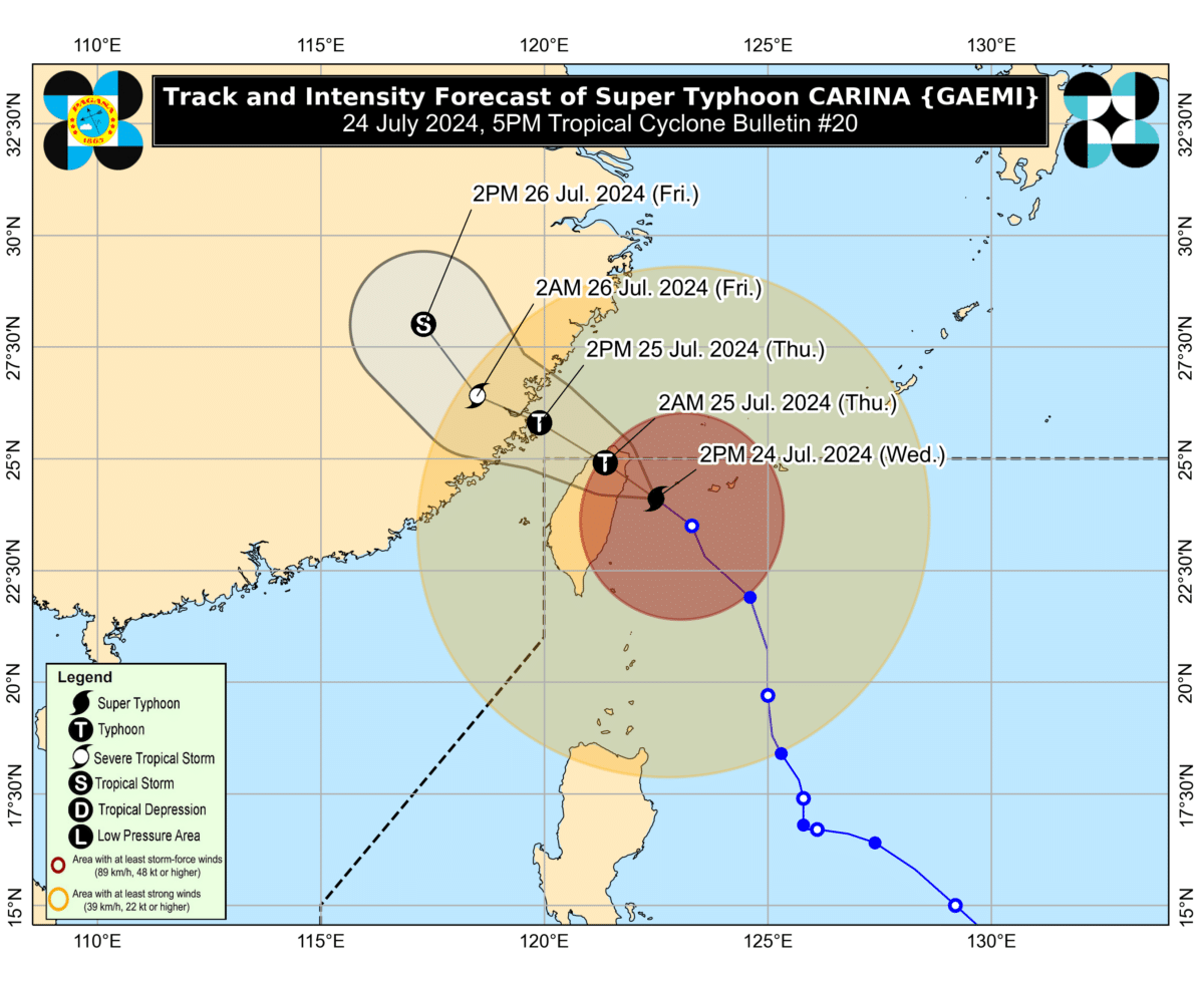
The latest bulletin from the Philippine Atmospheric, Geophysical and Astronomical Services Administration (Pagasa) showed that Carina now has maximum sustained winds of 175 kilometers per hour (km/h), and gustiness of up to 215 km/h.
Carina’s eye was last seen 335 kilometers north of Itbayat, Batanes, and was moving west at a speed of 15 km/h.
READ: Metro Manila now under state of calamity due to Typhoon Carina
According to Pagasa, the typhoon is not expected to directly affect the country but it will enhance the southwest monsoon, causing moderate to intense rainfall over the western parts of Luzon until the weekend.
Article continues after this advertisement“Typhoon Carina is now less likely to directly bring heavy rainfall over any portion of the country. However, the southwest monsoon enhanced by Carina will bring moderate to intense rainfall over various localities in the western portion of Luzon today through Saturday,” Pagasa said.
Article continues after this advertisementTropical Cyclone Wind Signal No. 2 remains hoisted over Batanes, while Signal No. 1 has been raised over these areas:
- Babuyan Islands
- the northern portion of mainland Cagayan (Claveria, Santa Praxedes, Sanchez-Mira, Pamplona, Abulug, Ballesteros, Aparri, Camalaniugan, Buguey, Santa Teresita, Santa Ana, Gonzaga)
- the northern portion of Ilocos Norte (Burgos, Bangui, Pagudpud, Dumalneg, Adams)
Pagasa said that the southwest monsoon can also cause strong to gale-force gusts over the following areas, from Wednesday to Thursday:
- Ilocos Region
- Cordillera Administrative Region
- Nueva Vizcaya
- Quirino
- eastern portion of Isabela
- Central Luzon
- Metro Manila
- Calabarzon
- Mimaropa
- Bicol Region
- Western Visayas
- Negros Occidental
- Northern Samar
Similar conditions will be felt on Friday for these areas:
- Batanes
- Babuyan Islands
- Ilocos Region
- Cordillera Administrative Region
- Nueva Vizcaya, Quirino
- the eastern portion of Isabela
- Central Luzon
- Metro Manila
- Calabarzon
- Mimaropa
- Bicol Region
- Western Visayas
Based on is current forecast track, Carina is expected to exit the Philippine area of responsibility on Thursday morning, before crossing over the Taiwan Strait, and making landfall over China by Thursday afternoon or Thursday night.
“Due to its prolonged interaction with the mountainous terrain of Taiwan over the past several hours, Carina has started to weaken a typhoon. Its landfall will result in a weakening trend which is forecast to continue for the remainder of the forecast period,” Pagasa noted.
Several roads and communities over Metro Manila and nearby provinces were flooded due to non-stop rains brought by the southwest monsoon, as intensified by Carina.
Classes at all levels and government work have been suspended in Metro Manila as the region was placed under a state of calamity.