
Typhoon Carina and its wind signals
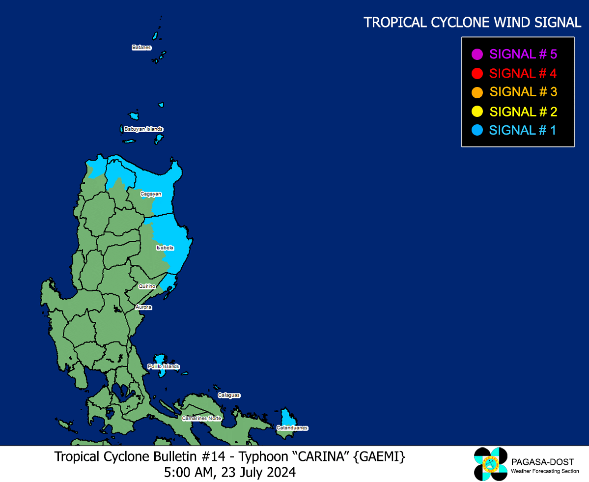
MANILA, Philippines — Ten areas in Luzon are under Tropical Cyclone Wind Signal (TCWS) No. 1 on Tuesday as Typhoon Carina (international name: Gaemi) maintained its strength, according to state meteorologists.
The Philippine Atmospheric, Geophysical and Astronomical Services Administration (Pagasa), in its early morning update, said Carina was spotted some 380 kilometers east-northeast of Tuguegarao City, Cagayan, packing maximum sustained winds of 130 kilometers per hour (kph) near the center and gustiness of up to 160 kph.

Carina is forecast to make landfall in the northern portion of Taiwan between Wednesday evening and Thursday morning, then exit the Philippine area of responsibility hours later.
Carina will induce the southwest monsoon or “habagat,” and trigger moderate to intense rainfall over the western portion of Luzon.
Meanwhile, a gale warning is in effect in Batanes and Babuyan Islands, where sea travel is risky for small vessels.
Areas under TCWS #1
- Batanes
- Babuyan Islands
- Northern and eastern portions of mainland Cagayan (Santa Ana, Gattaran, Baggao, Peñablanca, Lal-Lo, Gonzaga, Buguey, Santa Teresita, Aparri, Camalaniugan, Ballesteros, Allacapan, Abulug, Pamplona, Claveria, Sanchez-Mira, Santa Praxedes, Lasam, Alcala)
- Eastern portion of Isabela (Divilacan, Palanan, Maconacon, Dinapigue, Tumauini, Ilagan City, San Mariano, Cabagan, San Pablo, Santa Maria)
- Northern portion of Apayao (Calanasan, Luna, Pudtol, Flora, Santa Marcela)
- Northern portion of Ilocos Norte (Pagudpud, Bangui, Adams, Dumalneg, Burgos, Vintar)
- Northern portion of Aurora (Dilasag, Casiguran)
- Polillo Islands
- Calaguas Islands
- Northern portion of Catanduanes (Pandan, Bagamanoc, Panganiban, Viga, Gigmoto, Caramoran)