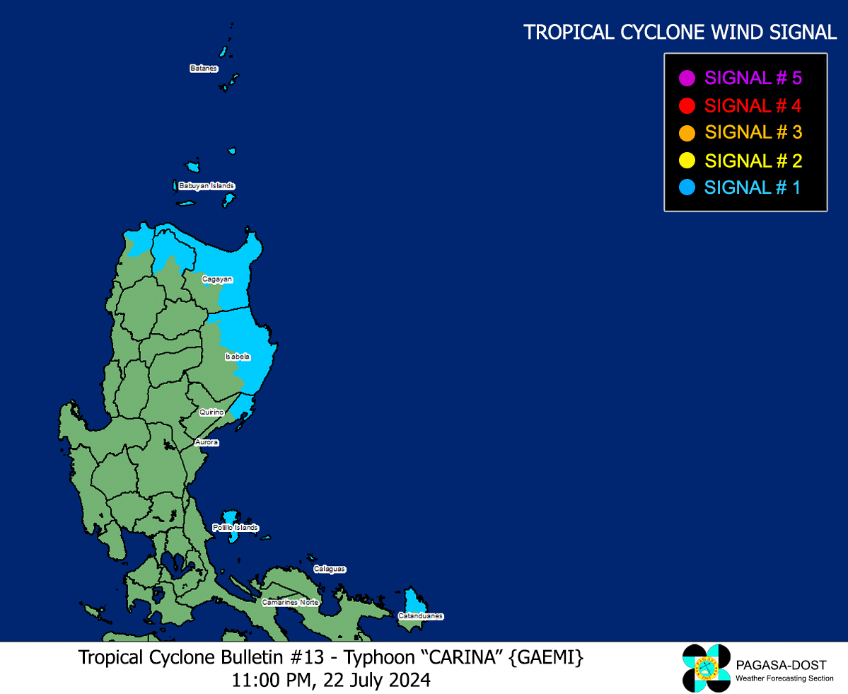

MANILA, Philippines — More areas are placed under tropical cyclone wind signal No. 1 on Monday night due to Typhoon Carina, state meteorologists said.
These eight areas are expected to have 39 to 61 kilometers per hour (km/h) wind speed, which causes minimal to minor threat to life and property, according to the Philippine Atmospheric, Geophysical and Astronomical Services Administration’s (Pagasa)’s 11 p.m. update:
- Batanes
- Babuyan Islands
- Northern and eastern portions of mainland Cagayan (Santa Ana, Gattaran, Baggao, Peñablanca, Lal-Lo, Gonzaga, Buguey, Santa Teresita, Aparri, Camalaniugan, Ballesteros, Allacapan, Abulug, Pamplona, Claveria, Sanchez-Mira, Santa Praxedes, Lasam, Alcala)
- Eastern portion of Isabela (Divilacan, Palanan, Maconacon, Dinapigue, Tumauini, Ilagan City, San Mariano, Cabagan, San Pablo, Santa Maria)
- Northern portion of Apayao (Calanasan, Luna, Pudtol, Flora, Santa Marcela)
- Northern portion of Ilocos Norte (Pagudpud, Bangui, Adams, Dumalneg, Burgos, Vintar), Northern portion of Aurora (Dilasag, Casiguran)
- Polillo Islands
- Calaguas Islands
- Northern portion of Catanduanes (Pandan, Bagamanoc, Panganiban, Viga, Gigmoto, Caramoran)
READ: Carina intensifies into typhoon; Signal no. 1 up in 4 Luzon areas
Pagasa said the typhoon was last spotted 375 kilometers east northeast of Tuguegarao City, Cagayan, packing maximum sustained winds of 130 km/h near the center and gustiness of up to 160 km/h.
Carina will remain far from the Philippine landmass, and is forecast to make landfall over the northern portion of Taiwan between Wednesday evening or Thursday morning before exiting the Philippine area of responsibility hours later, according to Pagasa.