


Track of Tropical Storm Carina, which “is forecast to reach typhoon category within 12 hours” or by Monday night, July 22, 2024, according to the Philippine Atmospheric, Geophysical, and Astronomical Services Administration’s (Pagasa). Photo from PAGASA/Facebook
MANILA, Philippines — Severe Tropical Storm Carina is seen to strengthen into a typhoon by Monday night, the Philippine Atmospheric, Geophysical, and Astronomical Services Administration’s (Pagasa) said.
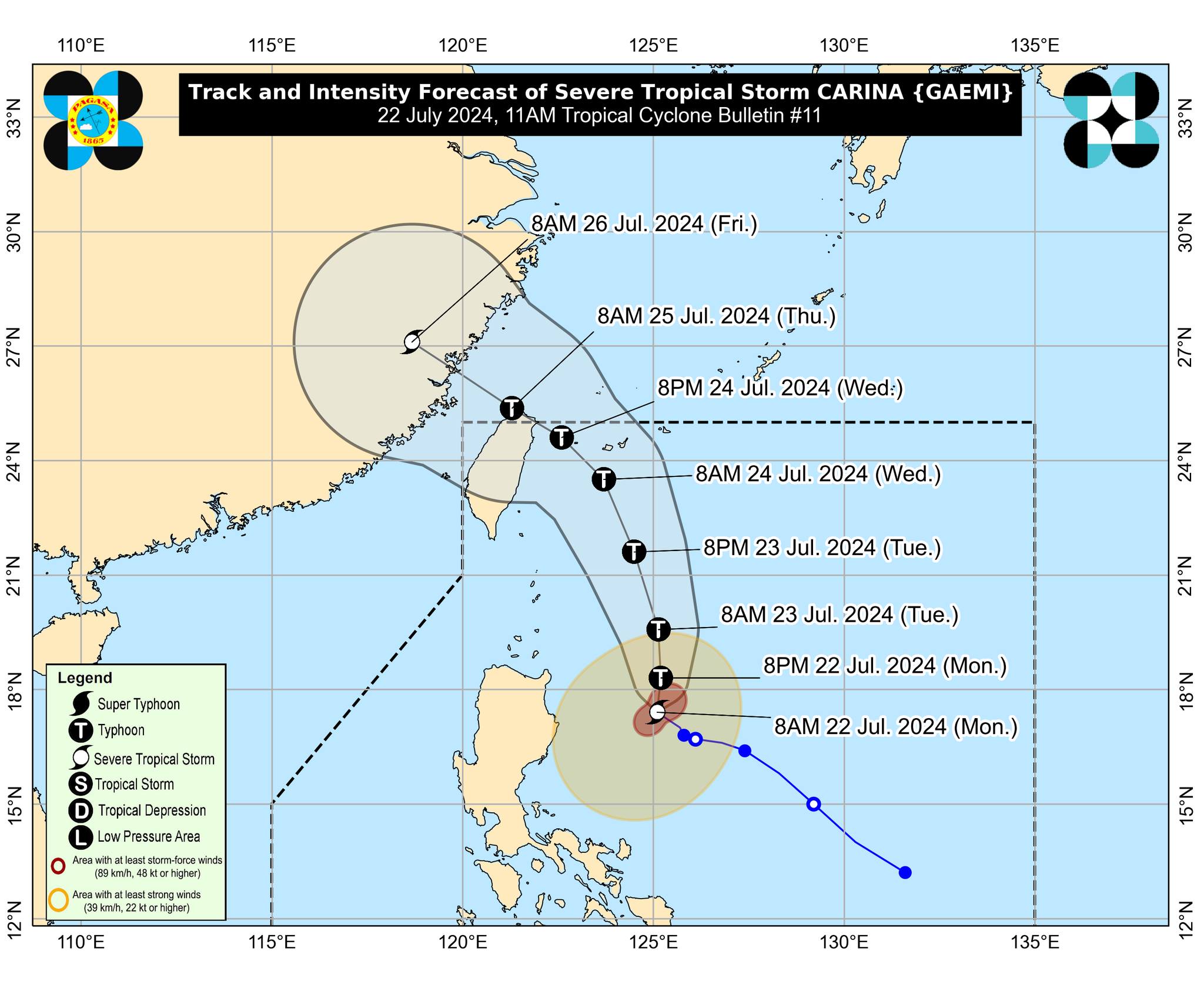
Based on the state weather agency’s 11 a.m. weather bulletin, Carina’s center was last spotted 340 kilometers east-northeast of Casiguran, Aurora, packing maximum sustained winds of 110 kilometers per hour (kph) near the center and gustiness of up to 135 kph.
“It is forecast to reach typhoon category within 12 hours,” Pagasa said.
READ: Carina now a severe tropical storm; Signal No. 1 up in Northeast Cagayan
However, the state meteorologist noted Carina will remain far from the country’s landmass and leave the Philippine area of responsibility by Wednesday evening or Thursday early morning.
READ: Parts of Cagayan, Isabela under Signal No. 1 due to Carina
Pagasa also sustained Tropical Cyclone Wind Signal No. 1 over the eastern portion of mainland Cagayan (Santa Ana, Gattaran, Baggao, Peñablanca, Lal-Lo, Gonzaga) including the eastern portion of Babuyan Islands (Camiguin Is., Babuyan Is.), and the northeastern portion of Isabela (Divilacan, Palanan, Maconacon).
Areas under Tropical Cyclone Wind Signal No. 1 may experience 39 to 61 kph wind speeds that pose minimal to minor threats to life and property, according to Pagasa.