
Image from Pagasa
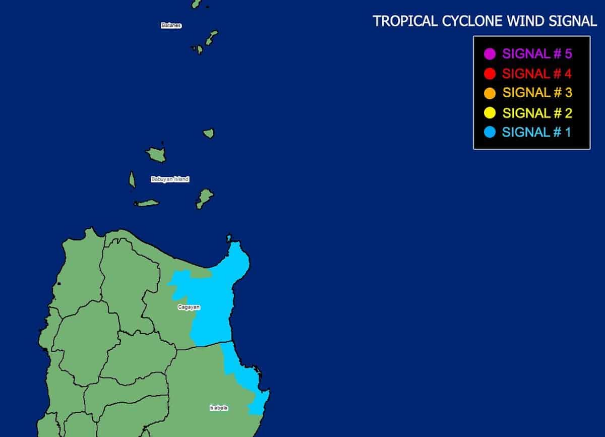
MANILA, Philippines — Parts of Cagayan and Isabela are under Tropical Cyclone Wind Signal No. 1 on Monday due to Severe Tropical Storm Carina (international name: Gaemi), state meteorologists said.
Under Signal No. 1 are the eastern portion of mainland Cagayan (Santa Ana, Gattaran, Baggao, Peñablanca, Lal-Lo, Gonzaga) and the northeastern portion of Isabela (Divilacan, Palanan, Maconacon).
These areas will have winds running at 39 to 61 kilometers per hour (kph), which may cause minimal to minor threat to life and property, are expected, according to the 4 a.m. update of the Philippine Atmospheric, Geophysical and Astronomical Services Administration’s (Pagasa).

READ: Carina now a severe tropical storm; Signal No. 1 up in Northeast Cagayan
Pagasa said Carina was last spotted 420 kilometers east of Tuguegarao City, Cagayan, packing maximum sustained winds of 100 kph near the center, with gustiness of up to 125 kph.
Carina is expected to reach the typhoon category by early Tuesday morning.
“Carina is forecast to steadily intensify over the next four days due to a favorable environment,” Pagasa said. “Rapid intensification within the forecast period is likely.”
This severe tropical cyclone is forecast to move generally north-northwest to north until Wednesday while gradually accelerating before turning northwestward for the remainder of the forecast period.
However, it will remain far from the country’s landmass and exit the Philippine area of responsibility on Wednesday evening or early morning of Thursday.