
Photo courtesy of Pagasa
MANILA, Philippines — Tropical storm Carina (international name: Gaemi) developed into a severe tropical storm off of east Casiguran on Sunday evening, according to the state weather bureau.
In its evening update, the Philippine Atmospheric, Geophysical and Astronomical Services Administration (Pagasa) reported that Carina was last monitored 385 kilometers East of Casiguran, Aurora.
READ: Storm Carina keeps strength, enhances southwest monsoon
The severe tropical storm is almost stationary, carrying maximum sustained winds of 95 kilometers per hour (km/h) near the center, with gustiness of up to 115 km/h.
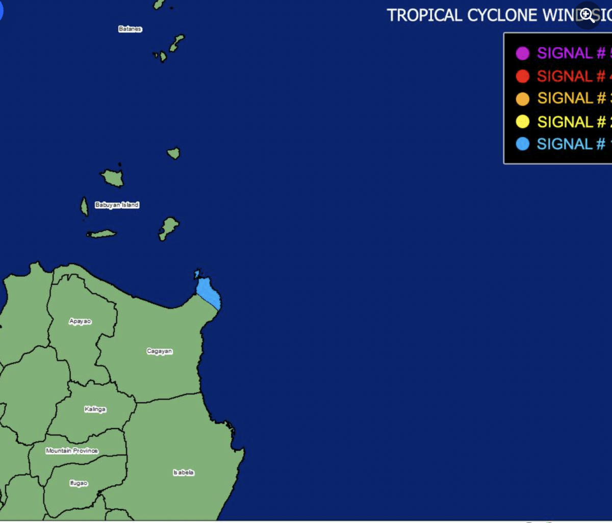
Following this development, Pagasa raised Tropical Cyclone Wind Signal Number 1 in the northeastern Cagayan (Sta Ana) portion.
“Minimal to minor impacts due to strong winds may be experienced within any of the localities where Wind Signal No. 1 is hoisted,” the state weather service said.
Moreover, Carina is also expected to enhance the southwest monsoon, locally known as habagat. It is expected to bring strong to gale-force gusts over Mimaropa, Bicol Region, Western Visayas, Northern Samar, and the northern portion of Samar (province).
“Over the Philippine Sea, Carina is forecast to move generally north-northwestward to northward until Tuesday (23 July) while gradually accelerating before turning northwestward on Wednesday (24 July) for the remainder of the forecast period,” Pagasa said.
“On the track forecast, Carina will remain far from the Philippine landmass and exit the Philippine Area of Responsibility on Wednesday evening or Thursday early morning (25 July) while moving near or over the islands in the Ryukyu archipelago,” it added.