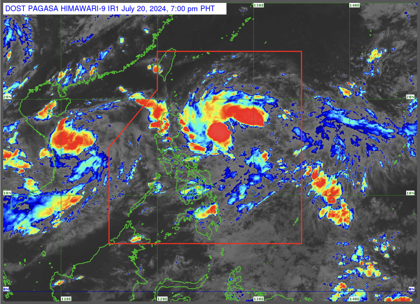
MANILA, Philippines — Tropical Depression Carina (international name: Gaemi) has intensified into a tropical storm as of 5:00 p.m on Saturday, according to the state weather bureau.

MANILA, Philippines — Tropical Depression Carina (international name: Gaemi) has intensified into a tropical storm as of 5:00 p.m on Saturday, according to the state weather bureau.
The Philippine Atmospheric, Geophysical and Astronomical Services Administration (Pagasa), in its latest bulletin, said that Carina is expected to further intensify into a severe tropical storm by Monday and a typhoon by Tuesday.
“Carina is forecast to steadily intensify and reach severe tropical storm by Monday. Beginning on Monday, the tropical cyclone will likely intensify further at a faster rate, eventually reaching typhoon category on Tuesday.”
Carina was last spotted by state meteorologists some 510 kilometers (km) east-northeast of Virac, Catanduanes, packing maximum sustained winds of 55 kilometers per hour (kph) near the center, gusts of up to 70 kph and moving west-northwest at 15 kph.
Carina will also strengthen the effects of the southwest monsoon together with a tropical depression outside the Philippine area of responsibility.
Hence, rains are expected in Zambales, Bataan and Kalayaan Islands on Sunday and in Metro Manila, Ilocos region, Zambales, Bataan, Batangas, Cavite, Occidental Mindoro and Northern Palawan on Monday.