
The Philippine Atmospheric, Geophysical and Astronomical Services Administration (Pagasa) says the southwest monsoon, locally called habagat, which is being enhanced by Tropical Depressions Butchoy and Carina, will bring cloudy skies, rain, and thunderstorms to many provinces nationwide on Saturday, July 20, 2024. (Photo courtesy of Pagasa)
MANILA, Philippines — Tropical Depressions Butchoy and Carina were enhancing the southwest monsoon, which is expected to bring cloudy skies, rain, and thunderstorms to many provinces nationwide.
The Philippine Atmospheric, Geophysical and Astronomical Services Administration (Pagasa) said the boosted southwest monsoon, locally called habagat, will affect Antique, Palawan, Occidental Mindoro, Zambales, Bataan, Mimaropa in Luzon, as well as parts of Visayas and Mindanao.
Localized thunderstorms, meanwhile, will cause slightly cloudy to cloudy skies with isolated rain showers or thunderstorms in Metro Manila and the rest of the country, according to Pagasa.
READ: Pagasa: 2 LPAs off Batangas, Catandauanes now TDs Butchoy, Carina
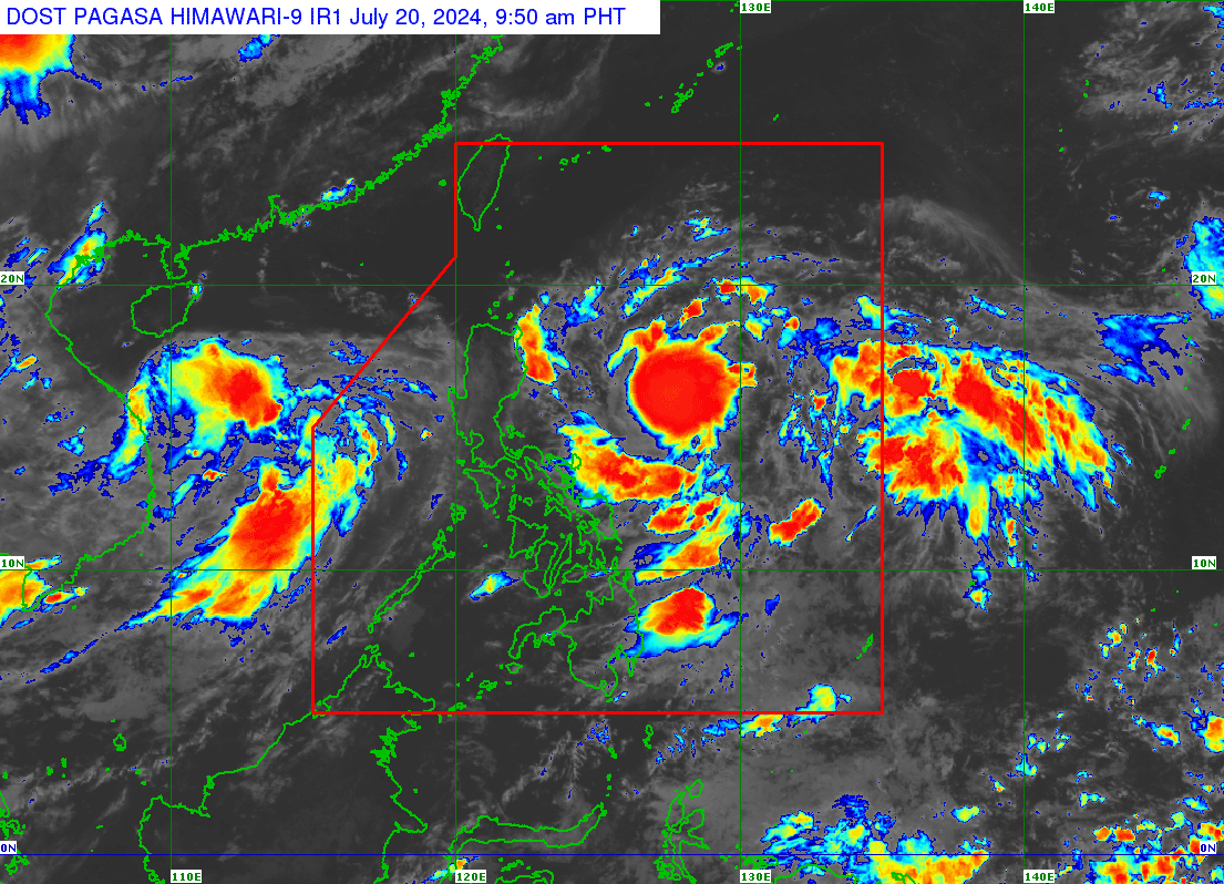
Pagasa: Butchoy’s PAR exit
On Tropical Depression Butchoy, the state weather agency said its center was last located 545 kilometers (km) west of Subic Bay. Butchoy was packing maximum sustained winds of 55 km per hour (kph) and gustiness of up to 70 kph and continued to move outside of the Philippine area of responsibility (PAR) in a westward-northwestward direction at a speed of 20 kph.
“Inaasahan natin na for the next 24 hours, or bukas madaling araw ng Linggo, ay ‘yung magiging location na ni Butchoy ay 910 km kanluran ng Central Luzon. Nasa labas na si Butchoy ng ating PAR by then,” said Pagasa weather specialist Daniel James Villamil.
(We expect that within the next 24 hours, or by early Sunday morning, Butchoy’s location will be 910 km west of Central Luzon. By then, Butchoy will be outside our PAR.)
He added that Butchoy may also reach the tropical storm category by Sunday, July 21.
READ: Pagasa says Lakas is a fake super typhoon: It doesn’t exist
As for Tropical Depression Carina, Pagasa said it was last seen 625 km east-northeast of Virac, Catanduanes. It was packing maximum sustained winds of 55 kph with gustiness of up to 70 kph, and moving northwest at a speed of 30 kph.
“For the next three to five days, may kalayuan po itong track nitong bagyong Carina sa bansa. Sa ngayon wala pang nakataas na tropical cyclone wind signal, ngunit hindi natin tinatanggal ‘yung posibilidad na magtaas tayo ng signal one sa mga susunod na araw sa areas ng extrement Northern Luzon at eastern section ng Northern Luzon area,” said Villamil.
(For the next three to five days, the track of Typhoon Carina is expected to be far from the country. As of now, no tropical cyclone wind signal is raised, but we do not rule out the possibility of raising signal one in the coming days for areas in extreme Northern Luzon and the eastern section of Northern Luzon.)
He likewise said that Carina may also reach the tropical storm category within the next 24 hours and the typhoon category by Monday, July 22.
Both tropical depressions remain less likely to bring heavy rainfall in the next three days, Villamil added.
Pagasa did not raise any gale warning alert over any of the country’s seaboards despite the presence of Butchoy and Carina, but it warned of moderate to rough coastal conditions due to the southwest monsoon.