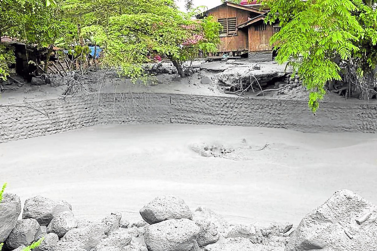
LAHAR FLOW This handout photo from the Office of the Protected Area Superintendent of Mt. Kanlaon Natural Park shows lahar overrunning a village of La Castellana in Negros Occidental. —AFP
BACOLOD CITY — Farmers in two cities and one town in Negros Occidental province lost more than P68 million worth of crops and fisheries due to the eruption of Mt. Kanlaon early this month, reports from the provincial government showed.
Dina Genzola, officer in charge of the Office of the Provincial Agriculturist, said the calamity had disrupted the livelihood of 885 farmers tilling 504.4 hectares of farmlands in the cities of Bago and La Carlota and La Castellana town.
Farmers cultivating high-value commercial crops posted the highest losses at P65,978,480 followed by those growing rice at P1,368,956.35 and corn at P555,000, Genzola said in a report to Gov. Eugenio Jose Lacson.
READ: Kanlaon Volcano blast ruins crops, taints water
Among the high-value crops damaged by the ash fall spewed by Mt. Kanlaon and the subsequent lahar flows were coffee, bananas, vegetables, and root crops in farms near the volcano on Negros Island.
Damage to fishponds was P595,000, reports said.
La Castellana Mayor Rhummyla Nicor-Mangilimutan said the farmers needed help for the rehabilitation of their farms.
Help needed“Food needs at evacuation centers can be addressed now but the rehabilitation of our farmers’ livelihood will be long-term. We are hoping the Kanlaon volcano’s alert level 2 (moderate level of volcanic unrest) goes down to [alert level] 1 (low level of volcanic unrest),” she said.
According to Nicor-Mangilimutan, residents still in evacuation centers are those from lahar-prone areas and whose communities are within the volcano’s 4-kilometer danger zone.
The Provincial Disaster Risk Reduction Management Council reported 2,922 evacuees in La Castellana evacuation centers as of June 13.
The Department of Environment and Natural Resources (DENR) will provide equipment to monitor air and water quality in areas close to Mt. Kanlaon following its eruption on June 3.
Environment Secretary Maria Antonia Yulo-Loyzaga was in Negros on Thursday to see how her department could assist government agencies in responding to the aftermath of the eruption.
“What we are trying to do is work very closely with the province in order to identify where it would be best to position the [scientific] instruments so that they can actually be effective in terms of decision-making,” Yulo-Loyzaga said.
“The issue here is the lahar is mobilizing wherever the waterways will allow it to flow. Whether that impacts the communities, agriculture, or the fish in the river, that will be the way they will determine where the instruments should be placed,” she added.
The DENR is also ready to support the Philippine Institute of Volcanology and Seismology in the delineation of Mt. Kanlaon’s danger zone.
“What we are here to do is to support in any way, perhaps in mapping support. Every time there is lahar, the configuration changes,” Loyzaga said.