Typhoon Aghon to leave PAR on Wednesday — Pagasa
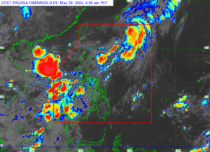
“It is possible for Aghon to exit PAR within this morning or later at noon based on our forecast track,” Pagasa weather specialist Obet Badrina. | Satellite image from Pagasa.
MANILA, Philippines — Typhoon Aghon (international name: Ewiniar) may leave the Philippine area of responsibility (PAR) by Wednesday morning or noon as it moves further away from the Philippine land mass.
Based on the latest forecast of the Philippine Atmospheric, Geophysical, and Astronomical Services Administration (Pagasa) latest forecast, Aghon was last located 870 kilometers east northeast of Extreme Northern Luzon.
READ: Aghon death toll at 7; Marcos says 6 regions hardest hit
It moves northeastward at 40 kilometers per hour (kph), carrying maximum sustained winds of 130 kph and gustiness of up to 160 kph.
“Posible ngayong umaga o mamayang tanghali ay lalabas na ng PAR base sa ating forecast track,” said Pagasa weather specialist Obet Badrina.
Article continues after this advertisement(Based on our forecast track, Aghon can exit PAR this morning or later at noon.)
Article continues after this advertisementMeanwhile, Pagasa monitors no other storms or low-pressure areas, making Aghon the only cyclone in May.
Rain to persist due to southwesterly wind flow
Despite Aghon moving further away from the country, rain is still expected to persist over several areas due to the effects of the southwesterly wind flow.
“Ito na rin ‘yung posibleng pagsisimula na rin ng panahon ng habagat, o southwest monsoon,” Badrina noted.
(This may also be the possible start of the habagat season or southwest monsoon.)
READ: Pagasa lifts Signal No.1 as Typhoon Aghon moves away from PH
The southwesterly wind flow is forecast to bring rain over parts of the Ilocos Region, Central Luzon, Metro Manila, Mimaropa, Western Visayas and Zamboanga Peninsula.
It is expected to bring 50 to 100 millimeters of rain in Occidental Mindoro, Palawan, Zambales and Bataan.
Isolated rain showers are also forecast over the rest of the country.
No gale warning is also currently raised, but moderate to rough sea conditions should still be expected over the seaboards of Luzon, with wave heights ranging from 2.1 to 3.5 meters.