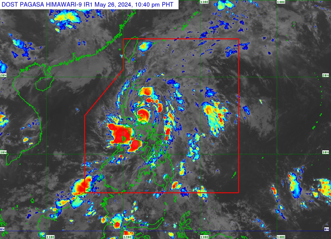
Aghon, now a typhoon, is over coastal waters of Burdeos, Quezon
MANILA, Philippines — Severe tropical storm Aghon (international name, Ewiniar) “rapidly intensified” into a typhoon as it arrived over the coastal waters of Burdeos, Quezon, on Sunday night, the state weather bureau reported.
In its 11 p.m. cyclone update, the Philippine Atmospheric, Geophysical and Astronomical Services Administration (Pagasa) said that Aghon is moving northwestward at 15 kilometers per hour (km/h), carrying maximum winds of 120 km/h and gusts of up to 180 km/h.
READ: Aghon makes landfall over Patnanungan Island, says Pagasa
Prior to this development, Aghon made another landfall over Patnanungan Island on top of the eight other landfalls recorded in various parts of Luzon over the weekend. The typhoon first landed in Guiuan, Eastern Samar, at around 11:20 p.m. on Friday (May 24).
Despite Aghon’s increased strength, Polillo Islands remain under Signal No. 3.
Article continues after this advertisementMeanwhile, wind signals are still raised in the following areas:
Article continues after this advertisementSignal No. 2
- Aurora
- The northern and central portions of Quezon (Real, General Nakar, Infanta, Mauban, Calauag, Perez, Alabat, Quezon)
- The northern portion of Camarines Norte (Santa Elena, Capalonga)
Signal No. 1
- The eastern portion of Isabela (Divilacan, San Mariano, San Guillermo, Jones, Echague, San Agustin, Ilagan City, Benito Soliven, City of Cauayan, Maconacon, Angadanan, Naguilian, Palanan, Dinapigue)
- The eastern portion of Quirino (Maddela, Nagtipunan, Aglipay)
- The eastern portion of Nueva Vizcaya (Alfonso Castaneda, Dupax del Sur, Dupax del Norte)
- The eastern portion of Nueva Ecija (General Tinio, Gabaldon, Bongabon, Pantabangan, Rizal, General Mamerto Natividad, Laur, Palayan City, Peñaranda, San Leonardo, City of Gapan, Cabanatuan City, Santa Rosa, San Isidro, Cabiao, San Antonio, Jaen, Llanera)
- The eastern portion of Pampanga (Candaba, San Luis, San Simon, Apalit, Santa Ana, Arayat, Mexico, Sasmuan, Macabebe, Masantol, Santo Tomas, Minalin, City of San Fernando, Bacolor)
- The southeastern portion of Bataan (Pilar, Orion, Limay, Mariveles)
- Bulacan
- Metro Manila
- Rizal, Cavite
- Laguna
- Batangas
- The rest of Quezon
- Marinduque
- The rest of Camarines Norte
- The northern portion of Camarines Sur (Siruma, Tinambac, Milaor, Cabusao, Camaligan, Pili, Sipocot, Pamplona, Ragay, San Fernando, Magarao, Minalabac, Del Gallego, Libmanan, Naga City, Calabanga, Bombon, Canaman, Pasacao, Gainza, Lupi)
Based on the forecast, Aghon will continue to intensify over the next two days “as it accelerates northeastward over the Philippine Sea.”
“The typhoon will exit the Philippine Area of Responsibility (PAR) on Wednesday afternoon or evening,” Pagasa said.
“Outside the PAR region, Aghon will continue moving northeastward towards the sea south of mainland Japan. A weakening trend may also begin by Thursday,” it added.
