Aghon develops into tropical storm, signal no. 2 raised in Quezon areas
MANILA, Philippines — Tropical Depression Aghon has developed into a tropical storm on Sunday as it moves northwestward over the coastal waters of Lucena City, Quezon, the state weather bureau said.
In its latest cyclone update, the Philippine Atmospheric, Geophysical and Astronomical Services Administration (Pagasa) reported that Aghon was last spotted over the province, moving 10 kilometers per hour (kph), while carrying maximum sustained winds of 65 kph and gustiness of up to 90 kph.


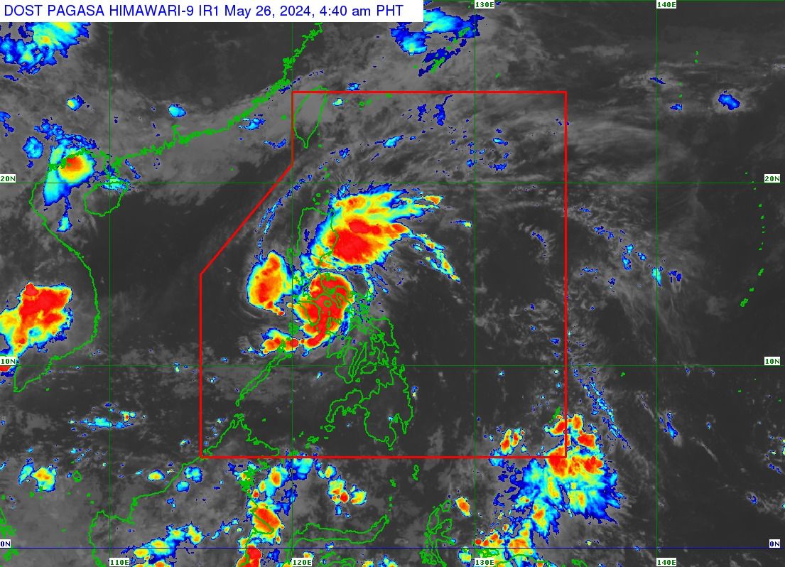
Tropical storm Aghon on Sunday morning, May 26, 2024 (Satellite image from Pagasa)
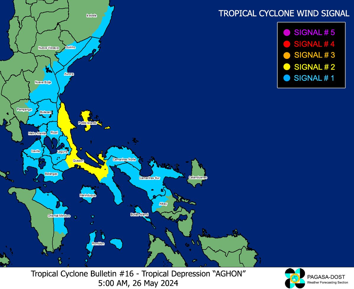
Following this development, Pagasa raised Tropical Cyclone Wind Signal (TCWS) Number 2 in the following areas in Quezon:
Article continues after this advertisementAlabat
Article continues after this advertisementPerez
Quezon
Gumaca
Lopez
Macalelon
General Luna
Unisan
Pitogo
Plaridel
Agdangan
Padre Burgos
Atimonan
Mauban
Real
General Nakar
Infanta
Sampaloc
Pagbilao
Calauag
Lucban
Tayabas City
Lucena City
Polillo Islands
Meanwhile, the following areas are under TCWS No. 1:
The southeastern portion of Isabela (Palanan, Dinapigue)
The southern portion of Quirino (Maddela, Nagtipunan)
The southern portion of Nueva Vizcaya (Alfonso Castaneda)
The eastern and southern portions of Nueva Ecija (General Tinio, Gabaldon, Bongabon, Pantabangan, Rizal, General Mamerto Natividad, Laur, Palayan City, Peñaranda, San Leonardo, City of Gapan, Cabanatuan City, Santa Rosa, San Isidro, Cabiao, San Antonio, Jaen)
Aurora
The eastern portion of Pampanga (Candaba, San Luis, San Simon, Apalit, Santa Ana, Arayat)
Bulacan
Metro Manila
The rest of Quezon
Rizal
Laguna
Cavite
Batangas
The northern portion of Oriental Mindoro (Pinamalayan, Pola, Naujan, Victoria, Socorro, City of Calapan, Bansud, Gloria, Baco, San Teodoro, Puerto Galera, Bongabong, Roxas)
Marinduque
Romblon
Camarines Norte
Camarines Sur
The northern portion of Albay (Tiwi, Polangui, Malinao, Libon, Oas, City of Ligao)
Burias Island
Moreover, the state weather service said Aghon’s influence has prompted it to hoist a gale warning over the coastal waters of Marinduque and Quezon, the southern coastal waters of Batangas, and the northern coastal waters of Camarines Norte.
Based on its forecast, the tropical storm may make landfall within the vicinity of Quezon within the next three hours.
“Over the next 12 hours, the [it] will cross the landmass of mainland Calabarzon and Polillo Islands. Aghon will be over the waters off the east coast of Quezon or Aurora by this evening or tomorrow early morning,” Pagasa said.
During this period, Agon will likely remain as a tropical storm although weakening into a tropical depression while over mainland Calabarzon is not ruled out due to land interaction,” it added.
