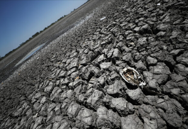
The skeleton of a fish is seen in the Navarro lagoon, which dried up due to the climate phenomenon La Nina, in Navarro, in Buenos Aires province, Argentina December 5, 2022. (REUTERS/File Photo)
The La Niña weather pattern could emerge in the second half of 2024, quickly after El Niño transitions into ENSO-neutral conditions in the middle of this year, a U.S. government weather forecaster said on Thursday.
The La Niña pattern is characterized by unusually cold temperatures in the equatorial Pacific Ocean and is linked with floods and drought.
“Even though forecasts made through the spring season tend to be less reliable, there is a historical tendency for La Niña to follow strong El Nino events,” the National Weather Service’s Climate Prediction Center (CPC) said.
The current El Niño weather pattern, which caused hot and dry weather in Asia and heavier than usual rains in parts of the Americas, is likely to give way to the ENSO-neutral conditions during April-June 2024, the CPC said in its monthly forecast.
ENSO neutral conditions refer to those periods in which neither El Niño nor La Niña is present, often coinciding with the transition between the two weather patterns.
“La Niña is likely to affect the production of wheat and corn in the US, and soybean and corn in Latin America including Brazil,” Sabrin Chowdhury, head of commodities at BMI said.
After a strong El Niño, global weather is poised to transition to La Nina in the second half of 2024, a pattern typically bringing higher precipitation to Australia, Southeast Asia and India, meteorologists and agricultural analysts said.
India, the world’s biggest rice supplier, restricted exports of the staple following a poor monsoon, while wheat output in No.2 exporter Australia took a hit. Palm oil plantations and rice farms in Southeast Asia received less than normal rains.
“The development of La Niña is beneficial for the Indian monsoon. Typically, the monsoon delivers abundant rainfall during La Niña years,” said an official with India Meteorological Department.
The June-September monsoon, which is vital for India’s $3 trillion economy, brings nearly 70% of the rain the country needs to water crops and replenish reservoirs and aquifers.