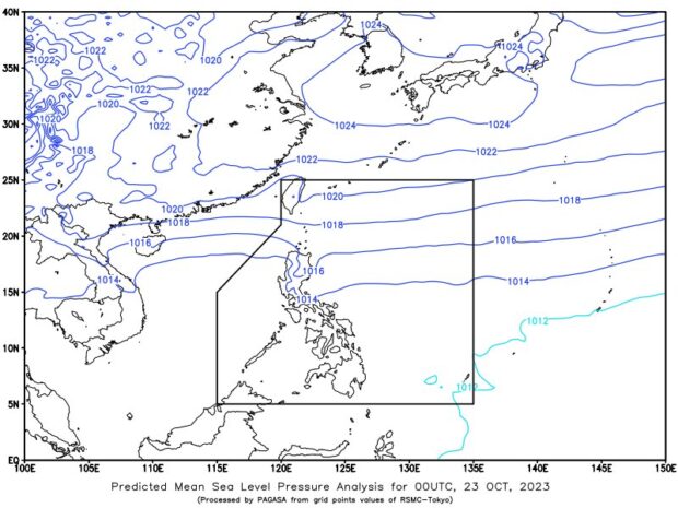
No low pressure area is likely to develop near the country’s boundaries within the week, but northeast monsoon, locally known as amihan. shear line, and localized thunderstorms will rain a large portion of the country, Pagasa said on Monday. Image from Pagasa
MANILA, Philippines — No low pressure area is likely to develop into a typhoon until the end of the week, the state weather bureau predicted on Monday.
However, the Philippine Atmospheric, Geophysical, and Astronomical Services Administration (Pagasa) said that overcast skies with rain will persist over a large part of the country throughout the day brought by three weather systems.
“Base sa pinakahuling datos, wala pa tayong binabantayan o namamataan na ano mang low pressure area [na] posible maging bagyo for this week. Posible po hanggang sa pagtatapos ng linggong ito maliit pa ‘yung tyansa na magkaroon tayo ng bagyo,” said state weather specialist Obet Badrina.
(Based on the latest data, we are not monitoring or observing any low pressure area [that] could become a typhoon for this week. It is possible that until the end of this week there is still a small chance that we will have a typhoon.)
According to Pagasa, cloudy skies with scattered rain showers and thunderstorms are expected over Metro Manila, Central Luzon, Calabarzon (Cavite, Laguna, Batangas, Rizal, and Quezon), the Bicol Region, Isabela, Quirino, and Nueva Vizcaya due to the shear line or the convergence of cool and warm winds.
READ: Cloudy skies, rains over northern Luzon due to northeast monsoon
Meanwhile, the Cordillera Administrative Region, Ilocos Region, and Cagayan Valley will experience cloudy skies with rain caused by the northeast monsoon, locally known as amihan.
The rest of the country, on the other hand, will have partly cloudy to cloudy skies with isolated rain showers or thunderstorms due to localized thunderstorms.
READ: Ready for the chill? Pagasa says ‘amihan’ begins
No gale warning has been issued for any part of the country’s seaboards, but Badrina warned those residing in low-lying areas to stay safe from possible flash floods or landslides brought about by moderate to heavy rains.