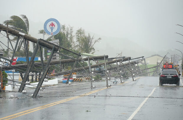
A car passes by power lines downed by the high winds from Typhoon Koinu in Taiwan’s southern Pingtung County on October 5, 2023. Typhoon Koinu grazed the southern edge of Taiwan on October 5, blanketing the region in torrential rain and bringing record-breaking winds of more than 340 kilometres an hour to an outlying island. AFP
BEIJING — Typhoon Koinu (locally named Jenny in the Philippines), which lashed Taiwan with rain and wind last week, on Sunday turned south over the sea off the coast of China’s Guangdong province towards the resort island of Hainan, with its intensity nearly unchanged from a day earlier.
As of 10 a.m. (0200 GMT), Koinu had yet to make landfall on the Chinese coast, maintaining its strength over water about 455 km (283 miles) northeast of the city of Zhanjiang in Guangdong, according to Chinese weather forecasters.
Koinu, packing gale-force winds of up to 144 kph (90 mph), is expected to churn south along the coast of Guangdong at a pace of up to 10 kph, weakening gradually as it reaches Zhanjiang city and the southern island province of Hainan.
In the Asian financial hub of Hong Kong, authorities issued their third-highest wind alert as Koinu brought gale-force winds to the territory, with heavy showers expected throughout Sunday and Monday.
Last week, Koinu, which means “puppy” in Japanese, killed one person and injured almost 400 people in Taiwan as it brushed past the south of the island.
Chinese authorities are on high alert even though Koinu looked unlikely to travel inland towards populous cities.
The slow movement of the typhoon over the warm waters of southern China raises the potential for very heavy rainfall as storm clouds linger over the area for a relatively long time.