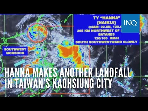
Hanna makes another landfall in Taiwan’s Kaohsiung City; Signal No. 1 stays over Batanes

MANILA, Philippines — Typhoon Hanna (international name: Haikui) made another landfall in Kaohsiung City in Taiwan, at 4 a.m. on Monday, the state weather bureau said.
Based on its 5 a.m. cyclone update, the Philippine Atmospheric, Geophysical, and Astronomical Services Administration (Pagasa) said Hanna was last spotted 265 kilometers northwest of Itbayat, Batanes, or within the vicinity of Kaohsiung City.
The typhoon was packing maximum sustained winds of 120 kilometers per hour (kph) with gustiness of up to 165 kph as it slowly moved south-southwestward.
Although Hanna is forecast to exit the Philippine area of responsibility (PAR) within six to 12 hours, Pagasa said Tropical Cyclone Wind Signal No. 1 would remain in effect in Batanes. Hanna is predicted to be 355 km northwest of Itbayat, Batanes, which is outside the PAR, by 2 p.m. Monday.
READ: LIST: Class suspensions for September 4 due to bad weather
Pagasa also said it is expecting Hanna to continue enhancing the southwest monsoon – locally termed habagat. This condition would trigger rains in the western part of Luzon and Antique until Wednesday (September 6), it added.
Habagat is likewise anticipated to bring windy conditions in Batanes, Babuyan Islands, Ilocos Region, Abra, Benguet, Apayao, Nueva Vizcaya, Zambales, Pampanga, Bataan, Bulacan, Metro Manila, Calabarzon (Cavite, Laguna, Batangas, Rizal, and Quezon), Bicol Region, Mimaropa, Occidental Mindoro, Marinduque, Romblon, and the northern portion of Palawan, and Western Visayas for the rest of the day.
READ: LIST: Canceled flights for September 4 due to Typhoon Hanna, southwest monsoon
The combined effects of Hanna and the southwest monsoon also prompted Pagasa to keep its gale warning over the seaboards of northern Luzon, western and southern Luzon, and western Visayas.
According to the state weather service, Hanna may weaken into a severe tropical storm while leaving PAR “due to prolonged interaction with the rugged terrain of Taiwan.”
READ: Hanna makes landfall in Taiwan; Signal No. 1 still up in Batanes, Babuyan Islands
“After its erratic movement, the typhoon will gradually move west-northwestward over the Taiwan Strait while weakening. It is forecast to make landfall over the coast of Guangdong or Fujian, China, tomorrow (September 5) morning or afternoon as a severe tropical storm,” Pagasa said.
“Rapid weakening will ensue as the tropical cyclone moves further inland over Guangdong, China. Hanna is forecast to become a remnant low on late Wednesday (September 6) or Thursday (September 7),” it also said.
READ: Hanna slows down while southwest monsoon continues to dump rain over Luzon