Heavy ‘habagat’ rain due to ‘Goring,’ ‘Hanna’ and ‘Kirogi’
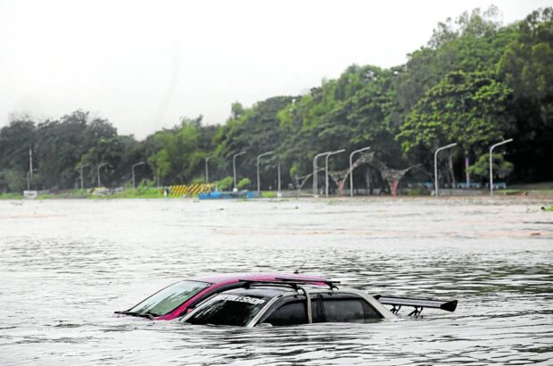
CAN’T DRIVE THESE Owners of these cars left at a riverside park in Marikina City have failed to bring their vehicles to higher ground as water level in Marikina River starts rising on Thursday morning amid heavy rains in Metro Manila. —LYN RILLON
The state weather bureau on Thursday said that three tropical cyclones surrounding the country are enhancing the southwest monsoon, or “habagat,” which is dumping severe rainfall in several areas.
In its 5 p.m. bulletin, the Philippine Atmospheric, Geophysical and Astronomical Services Administration (Pagasa) said Severe Tropical Storm “Hanna” (international name: Haikui) entered the Philippine area of responsibility only hours after Supertyphoon “Goring” (international name: Saola) exited, but another tropical storm, with international name “Kirogi,” is also hovering over the Pacific Ocean.
The combined effects of these three tropical cyclones will enhance the habagat and bring 100 to 200 millimeters (mm) worth of rain to Zambales, Bataan and Occidental Mindoro.
Residents of Metro Manila, Ilocos region, Abra, Benguet, Tarlac, Nueva Ecija, Pampanga, Bulacan, Cavite and Calamian Islands will experience 50 to 100 mm worth due to the weather phenomenon.
Pagasa said that Hanna was last seen 1,035 kilometers east of extreme northern Luzon, moving westward at 15 km per hour (kph) with sustained winds of 110 kph and gustiness of up to 135 kph.
Article continues after this advertisementHanna is forecast to reach its peak intensity late Saturday or early Sunday and turn into a typhoon 12 hours later.
Article continues after this advertisementIn separate advisories, Pagasa and the National Disaster Risk Reduction and Management Council also placed Metro Manila, Bataan, Zambales and Oriental Mindoro under orange rainfall warning, which indicates possible heavy rainfall, flooding and landslides on Thursday.
“Under these conditions, flooding and rain-induced landslides are expected especially in areas that are highly or very highly susceptible to these hazards as identified in hazard maps and in localities that experienced considerable amounts of rainfall for the past several days,” Pagasa warned.