Landslide-hit areas in Zamboanga, Cotabato declared danger zones

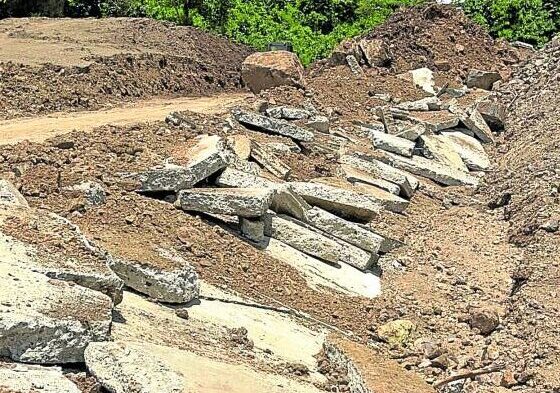
ERODED ROAD | A large section of the bypass road at Sitio Corote in Barangay Upper Malagutay, Zamboanga City, crumbles when the ground underneath it was loosened by heavy rains that caused a landslide on Aug. 15. (Photo by JULIE ALIPALA / Inquirer Mindanao)
ZAMBOANGA CITY, Zamboanga del Sur, Philippines — A settlement of more than 12 households in a village here and a remote subvillage in the town of President Roxas in Cotabato province have been declared as danger zones by their respective local governments due to the risks posed by landslides and soil erosion to these communities.
In Zamboanga City, Purok 5 of Sitio Corote of Barangay Upper Malagutay was found unsafe for people to live in, after an Aug. 15 landslide that buried at least two houses in the area following days of heavy rains that triggered massive soil erosion.
“We have blocked the area to prevent people from returning. Based on the ocular inspection we made, the soil in the area is categorized as high [risk] for soil erosion,” said Elmeir Apolinario, the city disaster risk reduction and management officer.
Allan de Guzman, barangay chair of Upper Malagutay, told the Inquirer it was their first time to experience a landslide that covered almost three hectares of property, with several cracks and scarps as deep as 20 meters below ground. Sitio Corote is about 1.5 kilometers from the barangay hall.
He said that aside from the five families who owned the landslide-hit properties, more than a dozen farming families living nearby were also affected.
About 40 m from the houses of the five families, the landslide also severely damaged a 160-m stretch of a 1-km bypass road that connected Upper Malagutay to Barangay San Roque, he added.
On Aug. 15, residents of Upper Malagutay were shaken when they heard continuous explosions from Purok 5, which turned out to be an avalanche of soil and huge stones that partly covered and created a 10-m scarp along the bypass road.
“We witnessed how the 12-inch thick cemented road cracked into pieces, [as if] an unseen giant hand broke the 160-m concrete road into pieces,” said De Guzman.
Engr. Allan Rommel Labayog, the regional field officer of the Philippine Institute of Volcanology and Seismology, said there was no earthquake recorded in the area but “the magnitude of devastation was really alarming.”
Labayog said they learned that the damaged bypass road used to be a creek and the water brought by the continuous heavy rain “accumulated in the spot and weakened the soil” and caused a landslide.
De Guzman confirmed that the bypass road was built over part of a creek.
He said villagers also detected soil movement and frequent falling of huge boulders from the mountain that had prompted village officials to close the bypass road constructed by the Department of Public Works and Highways.
Relocation underway
In Cotabato’s President Roxas town, the Mines and Geosciences Bureau 12 also declared Sitio Upper Ipuan of Barangay Poblacion as a “red zone” for landslides and flash floods, especially during a moderate to heavy downpour, said Mayor Jonathan Mahimpit.
Mahimpit said they were now fast-tracking the relocation of at least 30 families who fled their homes following the Aug. 19 landslide in the area after days of heavy rains dumped by the easterlies and Intertropical Convergence Zone.
“We bought the land and we will give it to the affected residents for free,” Mahimpit said, adding that all 35 households living at Sitio Upper Ipuan already agreed to be relocated to a half a hectare of land less than a kilometer away.
On July 5 this year, two villagers were swept away by a flash flood in the area. Their remains were found at least a few meters away from the town’s public market a day later.
RELATED STORIES
Heavy rains trigger floods and landslides in India’s Himalayan region, leaving at least 48 dead
Worker in drainage project dies during landslide in Northern Samar