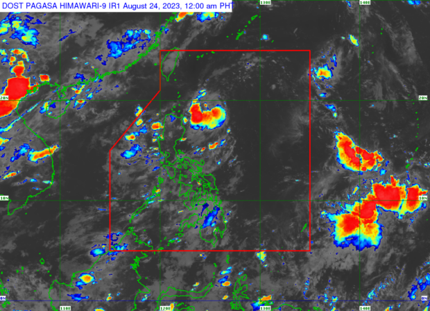
Goring now a tropical storm.
MANILA, Philippines — Tropical depression Goring has intensified into a tropical storm, the Philippine Atmospheric, Geophysical and Astronomical Services Administration (Pagasa) said Thursday afternoon.
In its 5:00 p.m. update Pagasa said Goring (international name: Saola) was spotted some 265 kilometers east of Basco, Batanes.
It has maximum sustained winds of 75 kilometers per hour (kph) and gustiness of up to 90 kph. It is moving northwest at 10 kph.
The state weather bureau said tropical cyclone wind signals may be raised by Thursday evening.
“The current forecast scenario shows that hoisting of tropical cyclone wind signals over areas in Northern Luzon may begin tonight or tomorrow in anticipation of the onset of tropical cyclone severe winds,” said Pagasa.
Pagasa said that Goring is “less likely” to trigger heavy rainfall in the next three days.
Considering the proximity of the tropical cyclone to land, however, any westward shift in the track forecast may result in heavy rainfall over parts of Cagayan Valley in the next three days.
The weather disturbance may also “steadily intensify” and reach severe storm category in the next 36 hours.
Pagasa also did not rule out the possibility that it may further intensify into a super typhoon.
By Saturday Goring may also enhance the southwest monsoon or “habagat” and trigger occasional rains over the western part of Luzon and windy conditions in Southern Luzon, Visayas, and Mindanao.