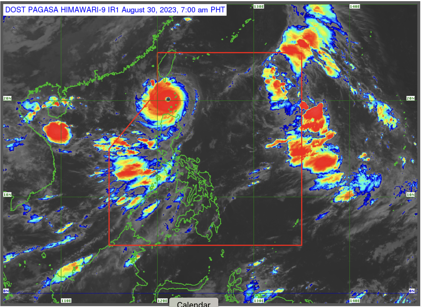

MANILA, Philippines – The tropical depression outside the Philippine area of responsibility (PAR) has intensified into a typhoon (international name: Lan), the state weather bureau said Thursday.
While it is not forecast to enter PAR, it will enhance the southwest monsoon or “habagat” and trigger rainfall, the Philippine Atmospheric, Geophysical and Astronomical Services Administration (Pagasa) said in its Thursday afternoon update.
“[P]atuloy nitong na-eenhance o napapalakas itong ating southwest monsoon o habagat na nakakaapekto ngayon sa buong bahagi ngayon ng ating kapuluan,” Pagasa weather specialist Ana Clauren-Jorda said.
(It [typhoon Lan] will continue to enhance the southwest monsoon or habagat, which is affecting the entire country.)
Metro Manila and the rest of Luzon will have a generally fair weather conditions on Thursday with scattered rains with lightning and thunder in the evening brought by the southwest monsoon.
LPA alert
Meanwhile, parts of the Visayas, Mindanao, as well as Albay, Sorsogon, Masbate, and Catanduanes, will experience rainy weather due to a low-pressure area (LPA) 235 kilometers east of Borongan, Samar, as well as the southwest monsoon.
The LPA is not expected to develop into a tropical cyclone, Pagasa added.
“Ang nasabing low pressure area ay hindi natin inaasahang maging isang bagyo, at posible rin itong matunaw sa susunod na mga araw,” Pagasa weather specialist Ana Clauren-Jorda said.
(The low pressure area is not expected to develop into a tropical cyclone, and it is possible that it will disintegrate in the following days.)