
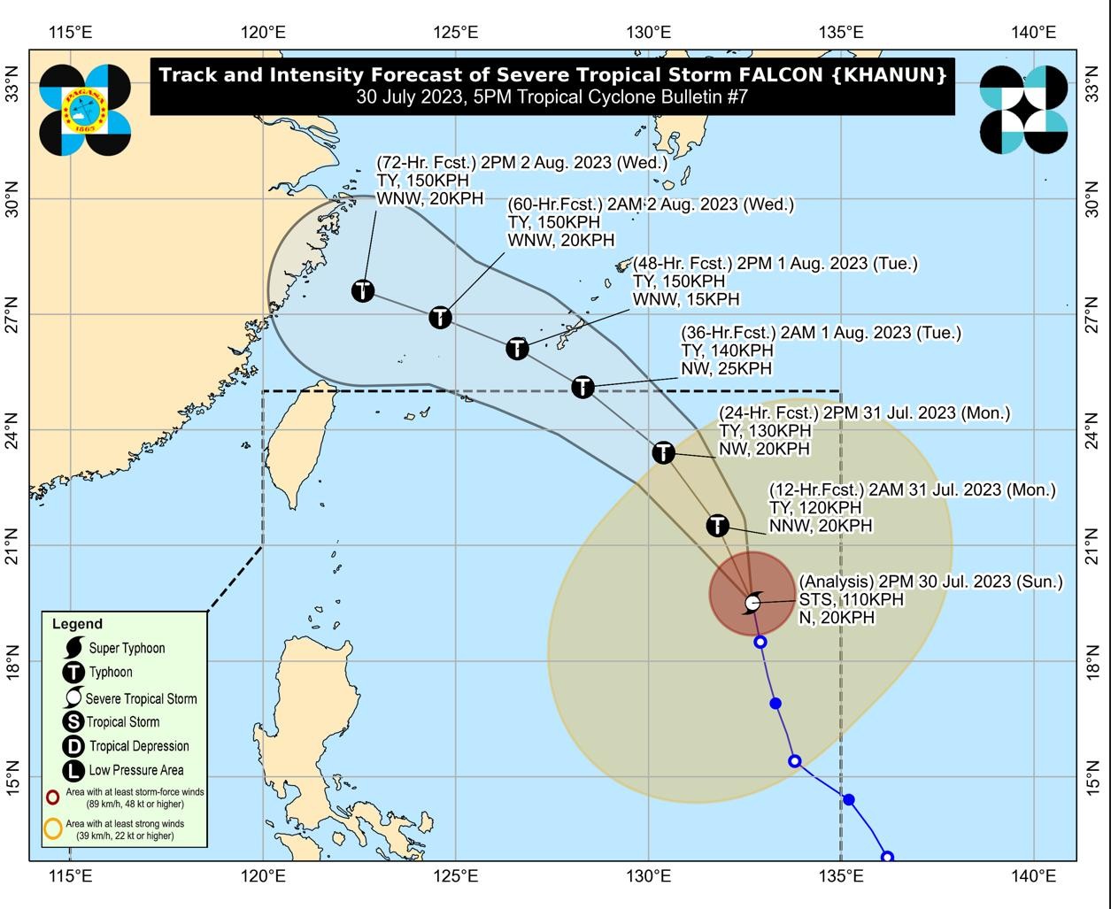
MANILA, Philippines — Severe Tropical Storm Falcon (international name: Khanun) has intensified while moving north over the Philippine Sea but may leave the Philippine area of responsibility (PAR) by Monday evening, the state weather bureau said on Sunday.

In its 5:00 p.m. update, the Philippine Atmospheric, Geophysical and Astronomical Services Administration (Pagasa) said that Falcon was tracked some 1,170 kilometers east of Northern Luzon.
Its maximum sustained wind speed increased from 95 kilometers per hour (kph) to 110 kph and gustiness from 115 kph to 135 kph.
Although Falcon has intensified, Pagasa said it is unlikely that tropical cyclone wind signals wind signals would be raised over any part of the country.
Falcon, however, will continue to enhance the southwest monsoon or “habagat,” and trigger occasional monsoon rains over the western portions of Luzon and Visayas in the next three days.
Among the provinces/ areas that likely be affected by the “habagat” are Zambales, Bataan, Pampanga, Bulacan, Metro Manila, Occidental Mindoro, Palawan, Romblon, Northern Samar, most parts of the Calabarzon (Cavite, Laguna, Batangas, Rizal, and Quezon) region, Bicol region and Western Visayas.
“On the track forecast, the severe tropical storm may exit the Philippine area of responsibility tomorrow evening or on Tuesday early morning,” Pagasa said.
“Outside the PAR, Falcon will turn west-northwestward and pass close to Okinawa Islands in the Ryukyu Archipelago on Tuesday morning before entering the East China Sea,” it added.