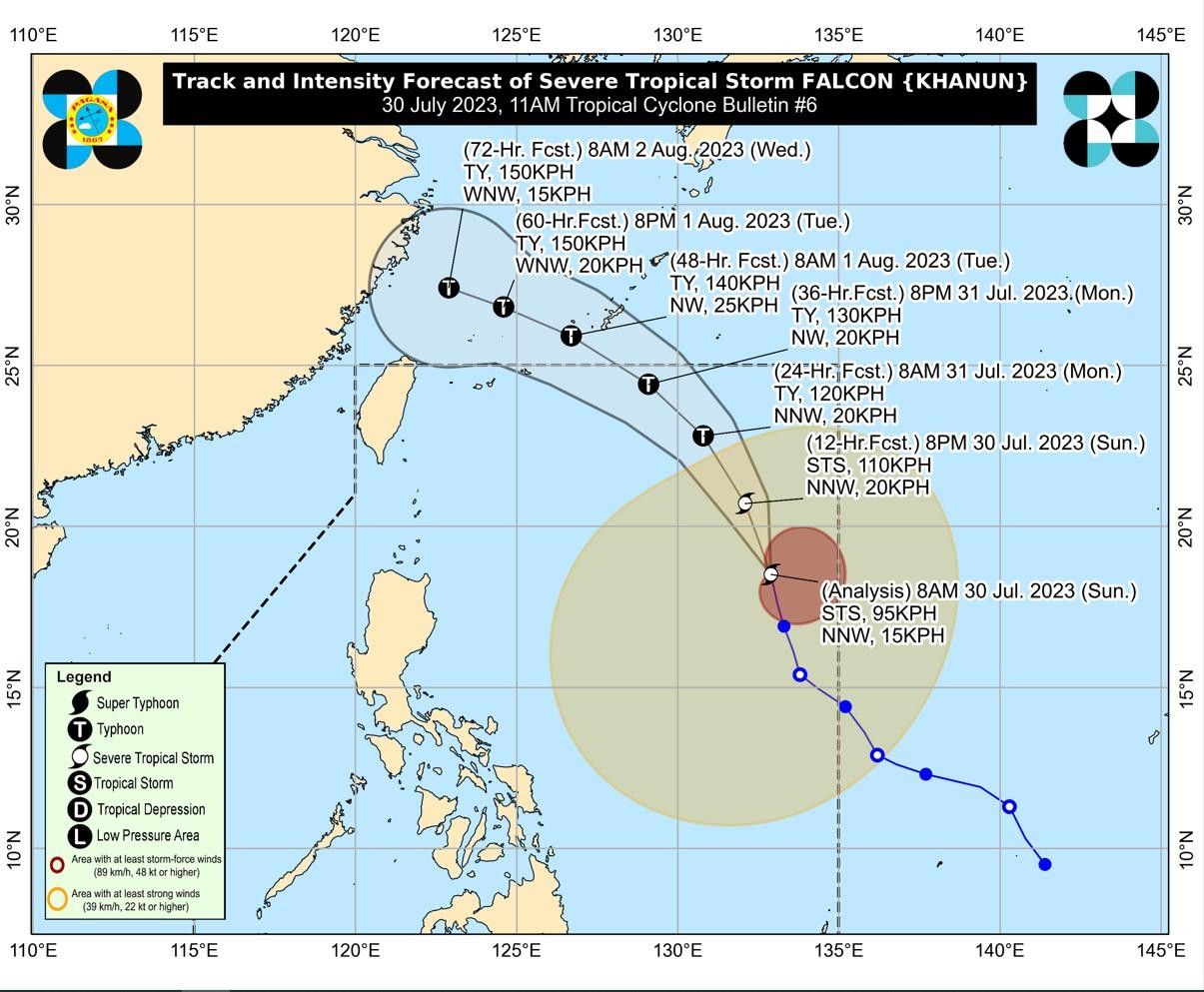
Falcon maintains strength, may become typhoon by Sunday evening

Severe tropical storm Falcon was moving 15 kilometers per hour and was last monitored 1,180 km east of Northern Luzon, carrying maximum sustained winds of 95 kph and gusts of up to 115 kph. (Photo courtesy of Pagasa)
MANILA, Philippines — Severe tropical storm Falcon (international name: Khanun) has maintained its strength and may become a typhoon by Sunday evening as it moves north-northwestward, the state weather bureau said.
According to its 11 a.m. weather bulletin, the Philippine Atmospheric, Geophysical and Astronomical Services Administration (Pagasa) said Falcon was moving 15 kilometers per hour (kph) and was last monitored 1,180 km east of Northern Luzon.
Falcon carries maximum sustained winds of 95 kph and gusts of up to 115 kph.
Pagasa said that no wind signals would be raised in any part of the country. Still, Falcon has enhanced the southwest monsoon or “habagat,” which may trigger occasional monsoon rains over the western portions of Luzon and Visayas in the next three days.
Article continues after this advertisementThe agency added that habagat would bring gusty conditions over the coastal and mountainous areas of Zambales, Bataan, Pampanga, Bulacan, Metro Manila, Occidental Mindoro, Palawan, Romblon, Northern Samar, and most of Calabarzon (Cavite, Laguna, Batangas, Rizal, and Quezon), Bicol Region and Western Visayas.
Article continues after this advertisement“The severe tropical storm may exit the Philippine area of responsibility tomorrow evening or on Tuesday (August 1) early morning. Outside the PAR region, Falcon will turn west-northwestward and pass close to Okinawa Islands in the Ryukyu Archipelago on Tuesday morning before entering the East China Sea,” Pagasa said.
“Falcon is forecast to intensify within the next three days steadily. It may reach its peak intensity on Tuesday,” it added.
RELATED STORIES
Pagasa: Falcon intensifies into severe tropical storm
NDRRMC: Egay and southwest monsoon affect over 600,000 locals nationwide