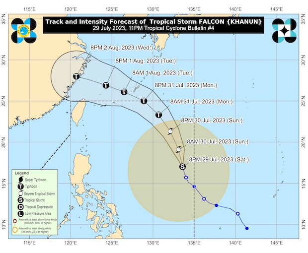

MANILA, Philippines — Tropical Storm Falcon (international name: Khanun) has further intensified over the Philippine Sea and is expected to do so steadily within the next three days.
It’s forecast to become a typhoon between late Sunday evening and Monday morning and reach its peak intensity on Tuesday.
It’s not expected to make landfall in the Philippines but in China on Wednesday afternoon or evening, according to the Saturday 11 p.m. bulletin of the Philippine Atmospheric, Geophysical and Astronomical Services Administration (Pagasa).
The storm is currently located about 1,210 kilometers east of Central Luzon and is moving north-northwestward at 15 kph. It has maximum sustained winds of 85 kph with a gustiness of up to 105 kph,
Pagasa warned of heavy rainfall and strong winds over the western portions of Luzon and Visayas in the next three days.
Residents in these areas are advised to take precautionary measures, such as staying indoors and avoiding travel if possible.
The storm is forecast to exit the Philippine Area of Responsibility (PAR) on Monday afternoon or evening.
Outside the PAR, Falcon will turn west-northwestward and pass close to Okinawa Islands in the Ryukyu Archipelago between Monday late evening and Tuesday morning. Afterwards, it will move over the East China Sea before making landfall along the east coast of China on Wednesday afternoon or evening.
(This article was generated with the assistance of artificial intelligence and reviewed by an editor.)