Baguio forest classification hampers titling of residential lands
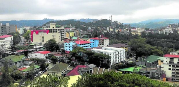
EMBRACED BY TREES Baguio City may have become overcrowded, but many of its residents continue to breathe fresh air as they live near pockets of pine forests for decades, as shown in this photo taken on May 17. —VINCENT CABREZA
BAGUIO CITY—The 2013 reclassification of Baguio residential zones into forest lands has been preventing many households from perfecting their land titles, allegedly due to erroneous data, the city council was informed on Monday.
But Elias Aoanan, acting deputy officer of the city planning, development and sustainability office, assured the city council that digital technology combined with GIS (Geographic Information System) and extensive ground validation should correct these errors once it updates the summer capital’s 2016 Comprehensive Land Use Plan (CLUP).
Families of the city’s Balacbac community near Mt. Santo Tomas first raised the anomaly at a citizens’ forum during the city council’s July 10 session. Before 2016, their area was classified for both residential and forest use.
Lawyer Roman Taguiling, who represented the Balacbac residents at the council session, said many households in the area have titles but the restrictive forest use classification could prohibit them from securing permits required for their livelihood and other transactions.
Other Balacbac settlers currently securing titles through Baguio’s townsite sales mechanism or the national government’s free patent program found their applications blocked because of the 2016 CLUP, Taguiling said.
Article continues after this advertisementThe 57-square-kilometer Baguio is the country’s remaining townsite reservation, where all lands are alienable and disposable and may be purchased through a laborious townsite sales application (TSA) process. Land transactions will not be cleared by the city and the Department of Environment and Natural Resources (DENR) if they are within forest lands. TSAs are approved by a joint task force manned by Baguio and DENR employees.
Article continues after this advertisementGoogle Maps
Aoanan acknowledged that the current CLUP, which was accomplished in 2013 but adopted officially in 2016 through Ordinance No. 62, bore no technical descriptions for zones identified for forest use. He said the CLUP forest land use map at the time was “based on Google Maps.”
Satellite images of Baguio that showed abundant trees were designated for forest use in 2013, Aoanan replied when pressed by Councilor Betty Lourdes Tabanda. However, Balacbac residents said many of their homes lie beneath pine tree canopies and might not have been spotted through Google Maps.
Among the areas affected by the reclassification of residential areas into forest use were settlements at Balacbac; the affluent neighborhood of Outlook Drive; portions of Barangay Irisan, which is Baguio’s largest village; Barangay Pinsao Proper; and residences at Camp 7 along Kennon Road.
According to the Department of the Interior and Local Government, 10-year CLUPs are mandated by Republic Act No. 7160 (the 1991 Local Government Code) to help regulate and determine the future development of land resources. Each CLUP illustrates how local governments like Baguio utilize public properties and preserve forest and government reservations through their respective zoning ordinances.
Twin city
The Baguio CLUP would be revised and upgraded by October, utilizing a 3D modeling application that Aoanan refers to as the Baguio Digital Twin City.
The summer capital’s Twin City project generates 3D representations of Baguio and all its barangays using all land resource data that is acquired scientifically or from methodical interviews and ground research conducted in each village. The digital twin helps experts analyze the geological conditions and the sturdiness of homes and buildings in Baguio. It also picks out illegal structures and danger zones that are inhabited.
According to the 2020 census, 363,151 residents make up Baguio’s household population (or 99.12 percent of the total population of 366,358).
A corrected CLUP could be officially adopted by the Baguio government in December, Aoanan said.
But the proposed CLUP corrections may end up reducing Baguio’s forest cover as depicted in the official land use map, said Councilor Peter Fianza, a former city administrator.
Baguio’s current number of residents has already breached the population threshold (about 324,000) for the city’s forest cover, according to a 2019 urban carrying capacity report. This means the current forest and green cover of the city are no longer sufficient to serve the current population.
The city currently has 2.5 million trees, including less than 50,000 Benguet pine trees.
RELATED STORY: