Pagasa: Rainy in parts of Luzon, Visayas; LPA forms off Mindanao
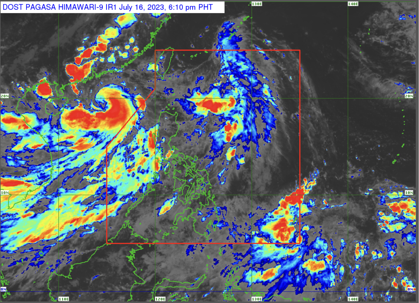
MANILA, Philippines — The southwest monsoon or “habagat” will continue to trigger rain showers in parts of Luzon and the Visayas, while the cloud cluster monitored outside the Philippine area of responsibility (PAR) has developed into a low-pressure area (LPA), the state weather bureau said on Sunday.
In its 3 p.m. bulletin, the Philippine Atmospheric, Geophysical and Astronomical Services Administration (Pagasa) said the effects of the “habagat” will be felt in most parts of Luzon and Western Visayas, while fair weather will prevail over the rest of the country.
“At ngayong araw inaasahang maulan sa Luzon at Western Visayas at ngayong araw sa nalalabing bahagi ng Visayas at Mindanao ay fair weather po tayo with chances of isolated rain showers due to thunderstorms,” Pagasa weather specialist Aldczar Aurelio said.
(Today, we are expecting rain in Luzon and Western Visayas, while rest of Visayas and Mindanao, we will have fair weather with chances of isolated raid showers due to thunderstorms.)
Article continues after this advertisementFlash floods and landslides are possible in rain-affected areas, Pagasa warned.
Article continues after this advertisementLPA, storm alert!
Aurelio, however, noted that the cloud cluster outside PAR has developed into an LPA and was last monitored some 1,265 kilometers east of Mindanao.
The LPA, Aurelio added, is likely to become a tropical cyclone within the next 24 to 48 hours.
Meantime, Tropical Storm Dodong (international name: Talim), which has exited PAR, was last monitored some 390 kilometers west of Laoag City, Ilocos Norte, moving 20 kilometers per hour (kph) and carrying packing maximum sustained winds of 85 kph and gusts of up to 105 kph.
Rough seas
Due to the “habagat”, gale warnings were raised over the seaboards of the following areas:
- Batanes
- Babuyan Islands
- Romblon
- Marinduque
- Ilocos Norte
- Ilocos Sur
- La Union
- Pangasinan
- Zambales
- Bataan
- western coast of Batangas
- Occidental Mindoro, including Lubang Island
- Palawan, including Calamian, Cagayancillo, Cuyo, and Kalayaan Islands
- southern coast of Quezon
- Antique
- Iloilo
- Guimaras
- northwestern coast of Aklan
Forecast temperature range in key cities / areas on Monday
- Metro Manila: 25 to 31 degrees Celsius
- Baguio City: 17 to 20 degrees Celsius
- Laoag City: 25 to 33 degrees Celsius
- Tuguegarao: 26 to 33 degrees Celsius
- Legazpi City: 25 to 31 degrees Celsius
- Puerto Princesa City: 25 to 30 degrees Celsius
- Tagaytay: 22 to 28 degrees Celsius
- Kalayaan Islands: 26 to 29 degrees Celsius
- Iloilo City: 25 to 30 degrees Celsius
- Cebu: 26 to 31 degrees Celsius
- Tacloban City: 25 to 33 degrees Celsius
- Cagayan De Oro City: 24 to 32 degrees Celsius
- Zamboanga City: 25 to 32 degrees Celsius
- Davao City: 26 to 32 degrees Celsius