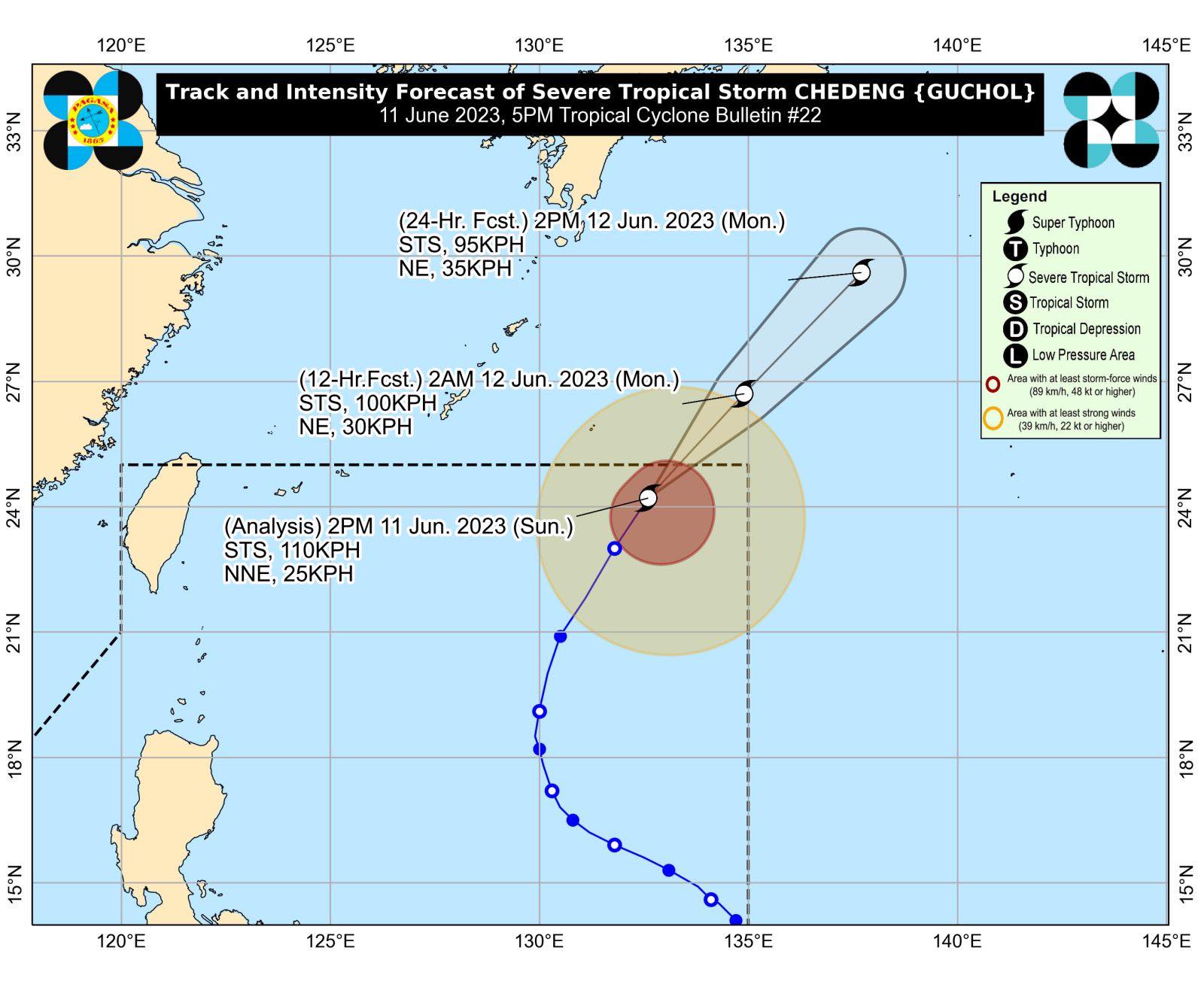

MANILA, Philippine — Chedeng (International name: Guchol) has weakened into a severe tropical storm as it continues to move north-northwestward over the Philippine Sea, according to the Philippine Atmospheric, Geophysical and Astronomical Services Administration (Pagasa).

Based on Pagasa’s 5 p.m. weather bulletin, Chedeng was last monitored 1,210 kilometers (km) east northeast of extreme Northern Luzon, moving 25 kilometers per hour (kph) and carrying maximum sustained winds of 110 kph and gusts of up to 135 kph.
Chedeng is forecast to exit the Philippine Area of Responsibility (PAR) around 2 a.m. on June 12 (Monday); however, it is expected to enhance the southwest monsoon or “habagat” for the next two days.
It will directly affect Batanes, Babuyan Islands, Ilocos Region, Cordillera Administrative Region, Nueva Vizcaya, Central Luzon, Metro Manila, Calabarzon (Cavite, Laguna, Batangas, Rizal, and Quezon), Occidental Mindoro, Oriental Mindoro, Romblon, Marinduque, northern mainland Palawan, Calamian Islands, Cuyo Islands, Kalayaan Islands, Bicol Region, and Western Visayas.
Moreover, Chedeng may also cause moderate to rough seas (2.0 to 3.0 m) over the seaboard of extreme Northern Luzon. The state weather bureau advised locals to take precautions when venturing to sea for fishing-related activities.
Pagasa said the tropical cyclone would continue to weaken until it exits PAR.
READ: Typhoon Chedeng further weakens, accelerates away from Philippine landmass