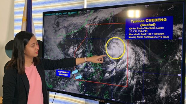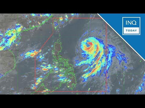
Pagasa’s weather specialist Ana Clauren-Jorda showing the satellite image of typhoon Chedeng during the 11 a.m. press briefing on Friday, June 9, 2023 in Quezon City. | Photo by INQUIRER.net / NOY MORCOSO
MANILA, Philippines — While state meteorologists are unlikely to raise a wind signal due to Typhoon Chedeng (international name Guchol), Visayas and several areas can expect rains due to the southwest monsoon or “habagat,” which was strengthened by Chedeng.
According to the Philippine Atmospheric, Geophysical and Astronomical Services Administration (Pagasa) on Friday, Chedeng is currently 885 kilometers east of northern Luzon.
The typhoon has maximum sustained winds of 130 kilometers per hour and gustiness of up to 160 kilometers per hour.
“The enhancement of the southwest monsoon over the next [three] days may bring gusty conditions today over the following areas: Visayas, including Romblon; Occidental Mindoro; northern portion of Palawan, including Kalayaan, Calamian, and Cuyo islands; Surigao del Norte; Dinagat islands, and Camiguin,” said Pagasa in a Facebook post.
The weather bureau also predicted Visayas, Calabarzon, Mimaropa, Bicol, Camiguin, and Dinagat would be affected by typhoon-enhanced monsoon rains on Saturday.
Residents in places where the rains prevail are warned by Pagasa of possible landslides and floods.
“Chedeng will remain far from the Philippine landmass and is now approaching the period where it will be closest to the country,” Pagasa said.
“It is forecast to move north-northwestward in the next 12 hours, before turning generally north or north-northeastward tomorrow,” it added.
Chedeng is expected to leave the Philippine area of responsibility by Monday.
RELATED STORIES:
Chedeng to enhance ‘habagat’, rain expected in parts of Luzon – Pagasa


