
Path of Typhoon Chedeng
MANILA, Philippines — Tropical Cyclone Chedeng intensified into a typhoon on Thursday, according to state meteorologists.

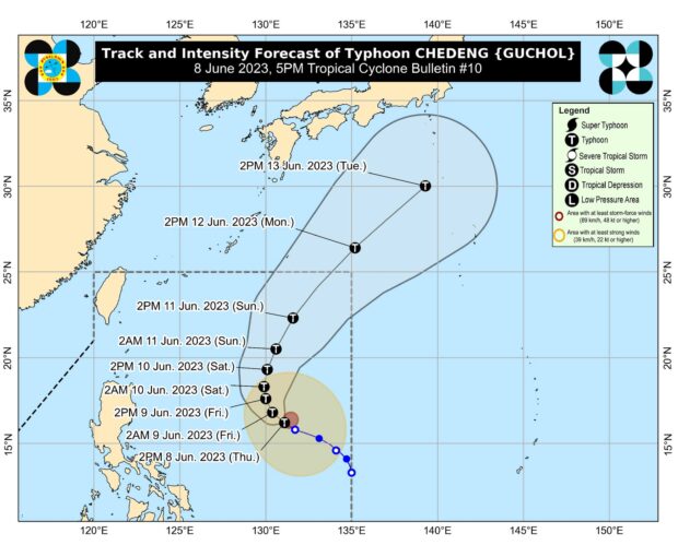
Chedeng was located 935 kilometers east of Central Luzon carrying maximum sustained winds of 120 kilometers per hour (kph) with gustiness reaching up to 150 kph, the Philippine Atmospheric, Geophysical and Astronomical Services Administration (Pagasa) said.
Pagasa said the typhoon will remain far from the country’s landmass and is unlikely to bring direct rainfall.
“Chedeng is unlikely to directly bring heavy rainfall over any portion of the country in the next 3 to 5 days,” the state weather bureau said.
“On the forecast track, Chedeng will remain far from the Philippine landmass. It is forecast to move generally west northwestward to northwestward until tomorrow afternoon before turning more northward the rest of tomorrow through Saturday afternoon.
From this point on, Chedeng will be slow-moving until Saturday before accelerating on Sunday, generally north northeastward or northeastward, the agency added.
Chedeng is expected to exit the Philippine area of responsibility on Monday.
RELATED STORY:
Tropical Storm Chedeng intensifies further; may leave PAR Monday