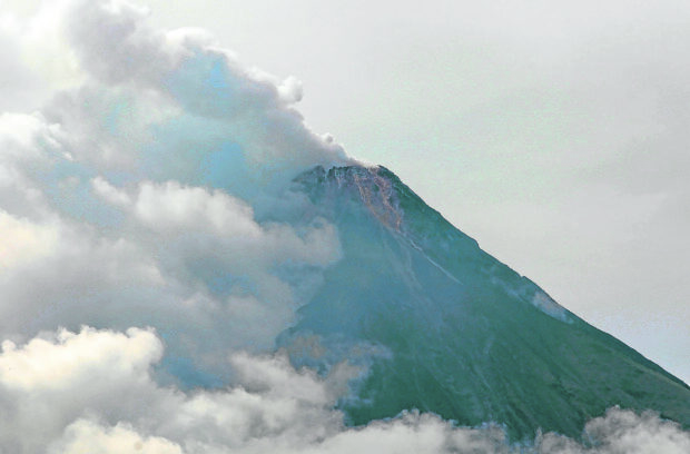
DECEPTIVE CALM | The summit of Mt. Mayon in Albay province, which is partly covered with clouds in this photo taken on June 5, 2023, appears calm but it has been under alert level 2 after exhibiting signs of unrest since Sunday, June 4, 2023. (Photo by MARK ALVIC ESPLANA / Inquirer Southern Luzon)
LEGAZPI CITY, Albay, Philippines — At least 5,000 mostly farming families living close to the slopes of Mt. Mayon were ordered on Tuesday to suspend all their activities within or at the boundary of the volcano’s 6-kilometer-radius permanent danger zone due to the threat of a “hazardous” eruption after state volcanologists raised its warning status to alert level 2 on Monday.
In Sto. Domingo alone, one of the eight localities in Albay province at the foot of the volcano, about 5,788 families, or 24,222 people, in high- and moderate-risk areas were advised to stop attending to their farms while Mayon remained restive, said Mayor Joseling Aguas Jr. These families were living near the danger zone and along the river channels in the villages of Lidong, Fidel Surtida, Santa Misericordia and San Isidro.
“Most of them own farmlands and are very active in quarrying operations near the 6-km danger zone,” Aguas said in a phone interview on Tuesday.
Aguas said they have already set up tents in open fields and had designated evacuation buildings for these families in case the volcano erupts.
On Monday, the Philippine Institute of Volcanology and Seismology (Phivolcs) raised the warning status of Mayon to alert level 2 due to the increasing number of rockfall events that indicate “increasing unrest” or the possibility of hazardous eruptions.
Legazpi, too
In Legazpi City, the local government has also prohibited all human activities, including all tourism-related events, inside the danger zone “because phreatic explosions and rockfalls can happen anytime,” said Miladee Azur, head of the city’s disaster risk reduction and management office, in an online chat message on Tuesday.
She said village officials were instructed to monitor their respective areas, especially the entry and exit points of the volcano.
She said around 13,000 residents in high-risk areas from the boundary of the danger zone to a 9-km radius in the villages of Mabinit, Bogña, Matanag, Buyoan and Padang would be the first to be evacuated if the situation worsened.
Lava debris
Paul Karson Alanis, a resident volcanologist at Phivolcs’ Mayon Volcano Observatory Station here, said the increase in rockfall events around the volcano was caused by “a shallow pressure at the lava dome.”
In its Tuesday bulletin, Phivolcs said they recorded 74 rockfall events, lasting from one to four minutes, based on seismic and visual observations in the past 24-hour monitoring period.
Phivolcs said thin brownish-gray ash from the rockfalls also drifted to the general southwest.
Alanis said materials from the rockfalls could possibly affect the southeast portion of the volcano, including the upland villages of Legazpi and the towns of Camalig, Daraga, and Santo Domingo.
“The crater lip is lower in these areas, so most of the materials go there,” Alanis explained.
The agency also monitored moderate degassing from the summit crater that produced steam-laden plumes drifting to the west-southwest portion, while sulfur dioxide emissions were last measured at an average of 208 tons per day on Monday.