Drawing courtesy of Pagasa
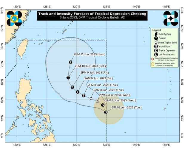
MANILA, Philippines — Tropical Depression Chedeng slightly intensified as it hovered inside the Philippine area of Responsibility east of Eastern Visayas, the Philippine Atmospheric, Geophysical and Astronomical Services Administration (Pagasa) said on Tuesday.
According to the 5 p.m. bulletin of Pagasa, Chedeng is almost stationary at 1,150 kilometers (km) east of Southeastern Luzon, with maximum sustained winds of 55 kilometers per hour (kph) and gustiness of up to 70 kph.
No wind signals are currently hoisted in any areas of the country.
The weather disturbance is forecast to bring heavy rainfall over most parts of the archipelago in the next three to five days.
“As Chedeng continues to consolidate while intensifying, it is forecast to gradually accelerate and generally move northwestward in the next 24 hours before turning west-northwestward on Thursday,” Pagasa said.
Afterwards, the tropical cyclone will begin turning towards the northwest on Friday and to the north during the weekend, the bulletin added.
Throughout the forecast period, Chedeng will remain far from the country’s landmass.
Aside from bringing heavy rainfall, the tropical depression is also expected to enhance the southwest monsoon or ‘habagat,’ which continuously affects the western part of the country.
RELATED STORIES:
Pagasa: Cloudy skies, rain in Palawan due to ‘habagat’; fair weather in rest of PH
LPA east of Eastern Visayas develops into Tropical Depression ‘Chedeng’