

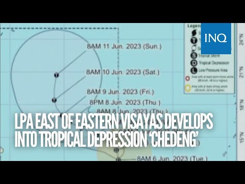
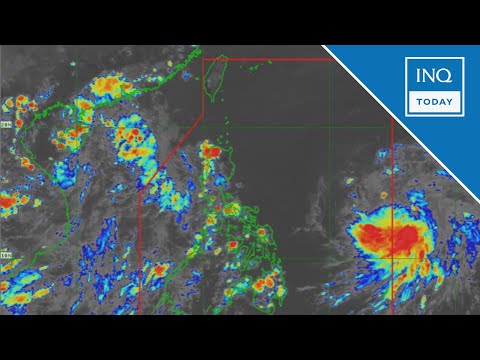
MANILA, Philippines — The low-pressure area formed east of Eastern Visayas strengthened, transforming into a tropical depression named “Chedeng” on Tuesday morning, said the Philippine Atmospheric, Geophysical and Astronomical Administration (Pagasa).
Based on Pagasa’s latest tropical cyclone bulletin, Chedeng was last spotted 1,170 kilometers east of southeastern Luzon, carrying maximum sustained winds of 45 kilometers per hour (kph) and gustiness of up to 55 kph.
“Tropical Depression Chedeng is forecast to remain far from the Philippine landmass. As such, it is unlikely to directly bring heavy rainfall over any portion of the country in the next three to five days,” Pagasa said.
It is forecast to accelerate and generally move northwestward before turning west-northwestward on Wednesday.
“Throughout the forecast period, Chedeng will remain far from the Philippine landmass,” the state weather bureau said.
However, Chedeng is expected to intensify in the next four days and may reach the tropical storm category by Wednesday and the typhoon category by Thursday.
Chedeng may enhance effects of ‘habagat’
While unlikely to hit the country directly, Pagasa warned that Chedeng might enhance the effects of the southwest monsoon.
But in the areas affected, its timing and intensity may still change depending on the movement and intensity of the tropical depression.
“As such, the public is advised to continue monitoring for updates regarding the possible enhancement of the Southwest Monsoon,” Pagasa said.
RELATED STORIES
Pagasa: Cloudy skies, rain in Palawan due to ‘habagat’; fair weather in rest of PH
Pagasa: LPA enters PAR; may become tropical cyclone within 24-48 hours