


Typhoon Betty’s trough, southwesterly wind flow to bring rain in parts of PH
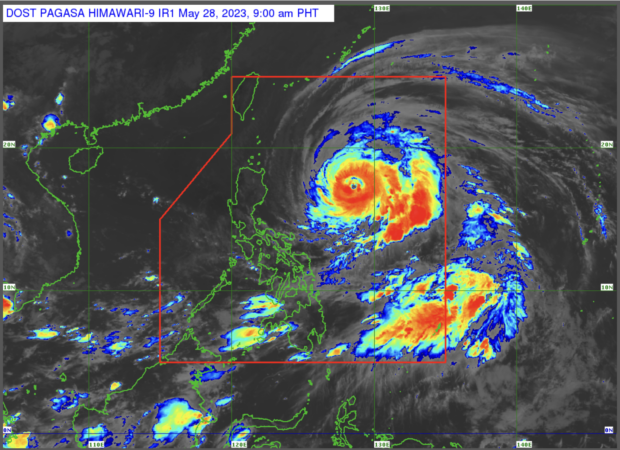
Weather satellite image from Pagasa’s website
MANILA, Philippines — The trough or extension of Betty, which has been downgraded from super typhoon to typhoon, and the southwesterly wind flow are predicted to cause rain over parts of the country on Sunday, the Philippine Atmospheric, Geophysical and Astronomical Services Administration (Pagasa) said.
Based on Pagasa’s 12 a.m., May 28, weather bulletin, Betty, which has the international name Mawar, weakened into a typhoon as it continuously accelerated over the Philippine Sea.
Pagasa said Betty was 800 kilometers east of northeast Luzon as of 4 a.m. on Sunday, packing maximum sustained winds of 125 kilometers per hour (kph) with gustiness of up to 215 kph.
In a report, state weather specialist Grace Castañeda said Betty was moving northwest at a speed of 20 kph.
LIVE UPDATES: Super Typhoon Mawar
“Ito ay kumikilos pahilagang-kanluran sa bilis na 20 kph at ngayon ay nakikita natin na ‘yung trough ni Typhoon Betty maging itong southwesterly wind flow ang magdudulot ng kalat-kalat na pag-ulan at pagkulog at pagkidlat,” Castañeda said in an early morning press briefing.
(It is moving northwest at a speed of 20 kph and now we see that the trough of Typhoon Betty and this southwesterly wind flow will cause scattered rain and thunder and lightning.)
READ: Betty to bring strong wind, rain over northern Luzon during its ‘crucial’ days – Pagasa
She further said that Betty is foreseen to travel west-northwestward or northwestward until Monday (May 29), and that the super typhoon is expected to decelerate and become slow-moving or almost stationary by Tuesday while over the coastal waters or east Batanes.
By Wednesday (May 31) or Thursday (June 1), Betty is estimated to resume moving north or north-northeast, she added.
Betty is anticipated to remain a typhoon throughout the forecast period, although it may weaken gradually until Tuesday (May 30). Betty may downgrade to a severe tropical storm category by late Thursday or early Friday, according to Pagasa.
Meanwhile, Tropical Cyclone Wind Signal No. 1 remained in effect over the following areas:
- Batanes
- Cagayan including Babuyan Islands
- Isabela
- Apayao
- Ilocos Norte
- Northern and central portions of Abra
- Kalinga
- Central and east parts of Mountain Province
- Central and east parts of Ifugao
- North and eastern portions of Aurora
- Quirino
- Northern portions of Nueva Vizcaya
RELATED STORIES
Pagasa warns of potential flash floods, landslides across PH
Betty to cause stormy waves; gale warning may be raised over PH’s eastern coasts – Pagasa
Owners urged not to leave pets behind as Super Typhoon Mawar approaches


