
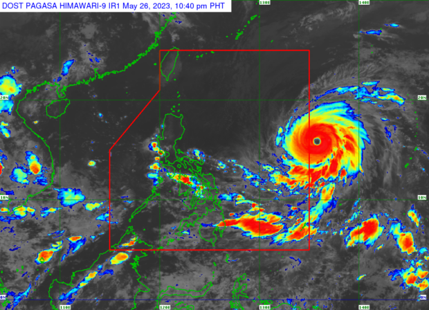
MANILA, Philippines — Super typhoon Mawar has slightly weakened as it is expected to enter the Philippine area of responsibility (PAR) early Saturday morning, according to the Philippine Atmospheric, Geophysical and Astronomical Services Administration (Pagasa).
Mawar, which will be given the local name Betty once it enters PAR, now packs a maximum wind speed of 205 kilometers per hour (kph) from 215 kph and gustiness of 250 kph from 260 kph earlier, Pagasa reported.
“Super typhoon Mawar is forecast to enter the PAR region tomorrow early morning. On the track forecast, the super typhoon will continue accelerating west northwestward until tomorrow before gradually decelerating on Sunday while maintaining its direction,” Pagasa saod in its Friday evening update.
The state weather bureau added that Mawar was last spotted some 1,475 kilometers east of Central Luzon and moving west northwest at 25 kph.
From its center, strong to typhoon force winds may extend up to 570 kilometers.
“Current forecast scenario shows that the typhoon may bring heavy rainfall over Northern Luzon (especially the northern and western portions) on Monday through Wednesday. In addition, strong to storm-force conditions may be experienced over extreme Northern Luzon and the northeastern portion of mainland Northern Luzon, while strong to gale-force conditions are possible over the northern and eastern portions of Northern Luzon mainland,” added Pagasa.Mawar is expected to maintain its super typhoon status until Tuesday, before it weakens into a typhoon while swirling east northeast of Itbayat, Batanes.