Pagasa: ‘Mawar’ now a super typhoon, may hit PH by weekend
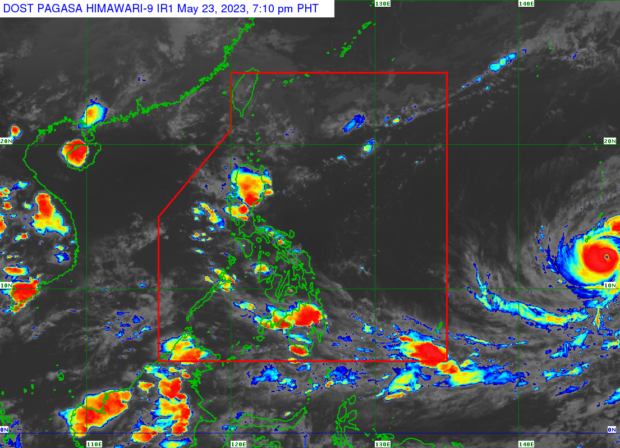
MANILA, Philippines — The tropical cyclone expected to enter the Philippine area of responsibility (PAR) has intensified into a super typhoon, the Philippine Atmospheric, Geophysical and Astronomical Services Administration (Pagasa) said on Tuesday.

Pagasa weather specialist Rhea Torres said “Mawar” intensified into a super typhoon as of 2:00 pm.
“As of 2 pm kanina ay tuluyan po itong lumakas at naging isang super typhoon,” Torres said in a public weather forecast.
(As of 2:00 p.m., Mawar has intensified into a super typhoon.)
Super typhoon Mawar was last spotted some 2,285 kilometers east of the Visayas and moving north at 15 kilometers per hour.
Torres also reiterated that the super typhoon could enter PAR by Friday or Saturday.
“Sa ngayon wala pa itong direktang epekto sa anumang bahagi ng ating bansa ngunit habang tinatahak nito ang karagatan ay posibleng lumapit ng ating PAR by Friday or Saturday,” she said.
(Currently, it does not have a direct effect but while moving over the sea, it could come near PAR by Friday or Saturday.)
Once it enters the PAR, the typhoon will be given the local name “Betty.”
It would be the second storm to hit the country this year and the first this month.
