
Weather satellite image from Pagasa’s website
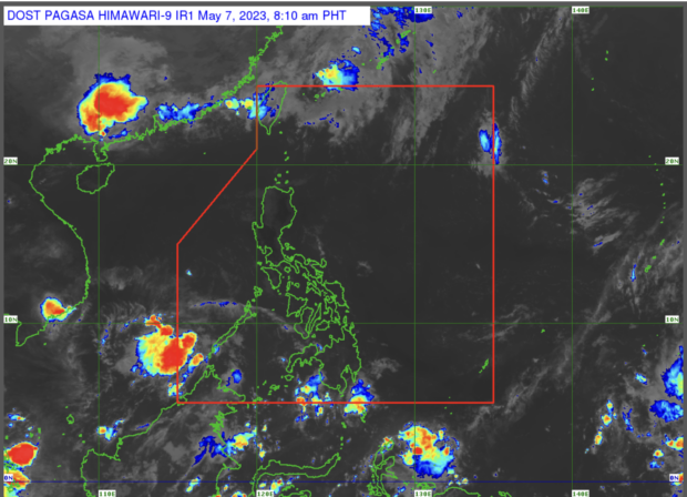
MANILA, Philippines — There are two low-pressure areas (LPAs) inside and outside the Philippine area of responsibility (PAR), the state weather bureau said on Sunday morning.
According to state weather specialist Patrick del Mundo, the LPA inside PAR was last spotted 410 kilometers northwest of Puerto Princesa City in Palawan province while the one outside PAR was 965 kilometers east of northeastern Mindanao.
The Philippine Atmospheric Geophysical and Astronomical Services Administration (Pagasa) said it is not expecting both LPAs to develop into a typhoon.
“Dalawang LPA na ating binabantayan, ‘yung isa ay nasa loob ng PAR at nanatiling mababa ang chansa nito maging bagyo sa next 24 hours at inaasahan nating lalabas ito ng ating PAR ngayong araw,” del Mundo said in a morning weather forecast.
(We are monitoring two LPAs, one of them is inside the PAR and the chance of it becoming a typhoon in the next 24 hours remains low, and we expect it to leave our PAR today.)
He added that the LPA east of northeastern Mindanao is expected to enter PAR within the day.
As for the rest of the country, the state weather service said that hot and humid weather with scattered rain will continue to prevail due to the easterlies.
READ: Pagasa officially declares start of dry season
Pagasa likewise issued its estimated temperature ranges in key cities and areas across the country for May 7. These are:
- Metro Manila: 27 to 36 degrees Celsius
- Baguio City: 18 to 28 degrees Celsius
- Laoag City: 26 to 34 degrees Celsius
- Tuguegarao: 25 to 37 degrees Celsius
- Legazpi City: 26 to 34 degrees Celsius
- Puerto Princesa City: 25 to 30 degrees Celsius
- Tagaytay: 22 to 33 degrees Celsius
- Kalayaan Islands: 26 to 29 degrees Celsius
- Iloilo City: 27 to 33 degrees Celsius
- Cebu: 27 to 32 degrees Celsius
- Tacloban City: 26 to 32 degrees Celsius
- Cagayan De Oro City: 25 to 32 degrees Celsius
- Zamboanga City: 26 to 36 degrees Celsius
- Davao City: 25 to 33 degrees Celsius
Del Mundo said no gale warning was hoisted over any of the country’s coastal waters at this time.
RELATED STORIES
LPA triggers rain in Palawan; Pagasa warns of possible floods, landslides
El Niño may bring more rain to western part of PH during habagat season – Pagasa