Pamalakaya: No need to map out PH’s fishing grounds, WPS is ours

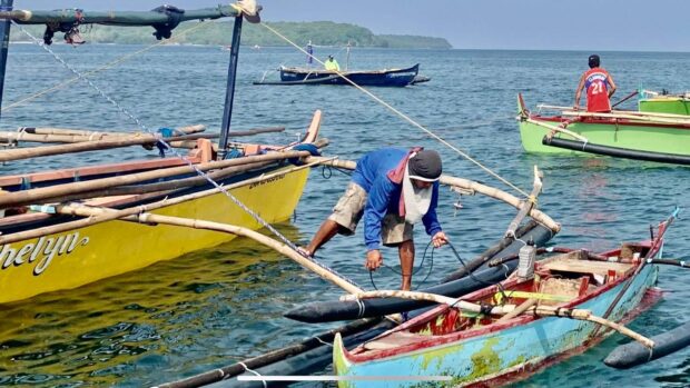
Most of the fishermen in Masinloc town, Zambales used to sail to Scarborough Shoal, their traditional fishing ground. But due to the escalating tension around the shoal amid the presence of the Chinese Coast Guard, local fisherfolk are now making a living within the municipal waters for fear of being harassed and bullied again by the Chinese. (Photo by Joanna Rose Aglibot)
SAN ANTONIO, Zambales – Fisherfolk group Pamalakaya on Tuesday, May 2, reiterated that the entirety of the West Philippine Sea (WPS) is exclusive territorial water for Filipinos and there is no need to prepare a map of the country’s fishing grounds.
Pamalakaya issued the statement after President Marcos told reporters during his flight to the U.S. capital that he had directed the Department of Foreign Affairs and the Philippine Coast Guard to prepare a map of the country’s fishing grounds.
“We remind Marcos that it was no less than the international court of arbitration that recognized our claim over the 220-nautical mile exclusive economic zone, as well as the additional 150-nautical mile extended continental shelf in WPS, said ” Bobby Roldan, Pamalakaya vice chair for Luzon said.
He added: “The entirety of the West Philippine Sea is legally, politically, and morally our fishing grounds that must be asserted and utilized at all times.”
Since 2012, China has seized control of the shoal and most parts of WPS, but the Philippine government filed a case against China before the international arbitration court, which came out in 2016, and classified the shoal as a traditional fishing ground that should be shared by neighboring countries.
Article continues after this advertisementBut China continues to control the shoal despite the UN court ruling.
Article continues after this advertisementIn several incidents in the last decade, Filipino fishermen experienced harassment and intimidation by the Chinese Coast Guard in Scarborough Shoal, their traditional fishing ground in the WPS.
Roldan, a fisherman from this province, lambasted the remark of Marcos Jr. as “defeatist and unbecoming of a national leader.”
“Why the need to draw a map that identifies our fishing grounds when we have every legal basis to uphold our territorial waters? Actively upholding our sovereign and territorial rights using the arbitral tribunal ruling is much less complicated than coming up with a map drawn for China’s approval,” Roldan said. INQ
lzb
For comprehensive coverage, in-depth analysis, visit our special page for West Philippine Sea updates. Stay informed with articles, videos, and expert opinions.