
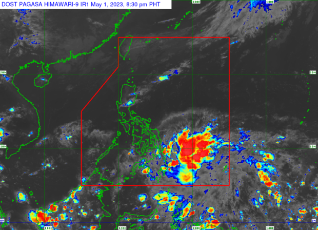
Weather satellite image from Pagasa’s website
MANILA, Philippines — A low-pressure area (LPA) and the intertropical convergence zone (ITCZ) are expected to bring rain and overcast skies to parts of the country on Tuesday, May 2.
The Philippine Atmospheric, Geophysical, and Astronomical Services Administration (Pagasa) said in its Monday afternoon forecast that the LPA was last spotted 975 kilometers east of Mindanao.
“Dahil sa patuloy na epekto ng ITCZ at patuloy na paglapit ng LPA, patuloy na makakaranas ng mauulap na kalangitan at kalat-kalat na pagulan sa Eastern Visayas at buong Mindanao,” said Pagasa weather forecaster Daniel James Villamil. The rest of Visayas, on the other hand, will have relatively fairer weather.
(Due to the continued effects of the ITCZ and as the LPA moves closer, Eastern Visayas and the whole of Mindanao will continue to experience cloudy skies and scattered rains.)
Pagasa also reiterated that the LPA still has no chance of developing into a tropical storm.
As for the easterlies, the state weather service said it would continue to bring generally fair weather throughout Luzon, with hot and humid temperatures and chances of rain due to isolated thunderstorms.
The temperature range in key cities or areas across the country for Tuesday, based on Pagasa’s latest forecast, are:
- Metro Manila: 26 to 34 degrees Celsius
- Baguio City: 17 to 27 degrees Celsius
- Laoag City: 25 to 34 degrees Celsius
- Tuguegarao: 25 to 35 degrees Celsius
- Legazpi City: 23 to 34 degrees Celsius
- Puerto Princesa City: 25 to 31 degrees Celsius
- Tagaytay: 23 to 31 degrees Celsius
- Kalayaan Islands: 26 to 32 degrees Celsius
- Iloilo City: 28 to 33 degrees Celsius
- Cebu: 25 to 31 degrees Celsius
- Tacloban City: 24 to 30 degrees Celsius
- Cagayan De Oro City: 25 to 30 degrees Celsius
- Zamboanga City: 25 to 35 degrees Celsius
- Davao City: 24 to 34 degrees Celsius
Amid these predicted weather conditions, the state weather bureau said it did not raise any gale warning in any part of the archipelago’s seaboards or in-land seas.
RELATED STORIES
Fair and warm weather to prevail over PH; ITCZ to bring rain in Palawan, Mindanao
Pagasa: Generally fair Sunday weather with a chance of rain
Sizzling Friday: Heat index may exceed 40°C, Pagasa warns