Spring storm rolls across US midsection, threatening tornadoes, heavy snow

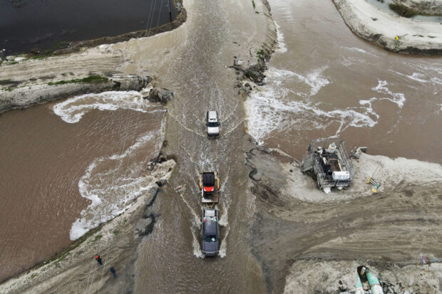
Vehicles pass next to a break in a levee as floodwaters inundate roads after days of heavy rain in Alpaugh, California, U.S., March 30, 2023. REUTERS/David Swanson
CHICAGO — A powerful spring storm system was sweeping across the United States on Friday, menacing the country’s midsection with the threat of dangerous tornadoes, blizzards, and freezing rains, forecasters said.
Tens of millions of Americans across the Great Plans, Midwest, South, and East could expect to be under weather watches and warnings on Friday afternoon and evening, and into the weekend, the National Weather Service said.
The round of severe weather comes a week after thunderstorms unleashed a tornado that devastated the Mississippi town of Rolling Fork, destroying many of the community’s 400 homes and killing 26 people.
The National Weather Service has issued a tornado watch for eastern and central Iowa, northwestern Illinois, northeastern Missouri, and the southwest corner of Wisconsin. It urged the 5 million people living in the region to be prepared for numerous strong tornadoes on Friday afternoon and evening.
“This is a particularly dangerous situation,” it said.
READ: Winter storms drench California with flooding, bury Northeast under snow
Northeastern Arkansas, Missouri’s southern boot-heel, western Kentucky, and western Tennessee were also at risk for tornadoes, the weather service said.
Several Midwestern cities including Chicago were possibly in harm’s way of the severe weather, it added.
“There’s a potential for some very strong tornadoes and some tornadoes that could be on the ground for quite some time, especially in northern Arkansas and western Tennessee,” said John Feerick, senior meteorologist at private forecasting service AccuWeather.
Rich Banns, a meteorologist for the National Weather Service Weather Prediction Center in Maryland, said thunderstorms were possible along a 1,000-mile-long (1,600 km) front that could unleash damaging straight-line winds, as well as hail and downpours capable of triggering flash floods.
READ: California copes with heavy rain, flooding in latest ‘atmospheric river’ storm
The northern, colder edge of the storm system, stretching from the High Plains to the upper Great Lakes, could bring heavy snow, combining with winds gusting up to 50 miles per hour (80 km per hour) to create white-out conditions.
“It’s going to be a tale of two storms for a place like Wisconsin, with blizzards to the north and severe thunderstorms to the south,” Feerick said.
Somewhere in the middle, arching across parts of several states, is a swath of the northern Midwest that is expected to be besieged by intense ice storms, with freezing rain wreaking havoc on roads and power lines.
The storm system is set to intensify through Friday as the sprawling low-pressure system at its core moves farther eastward, drawing up greater moisture from the Gulf of Mexico, Feerick said.
READ: 12 dead in Buffalo as winter storm freezes eastern U.S. on Christmas Day
In contrast to extremely wet, windy weather along the leading eastern edge of the enormous weather pattern, its southwestern flank will feature a very different hazard, as gusty conditions and low humidity combine to pose a heightened threat of wildfires.
“Red flag” warnings for elevated fire risks and high-wind warnings were posted from eastern New Mexico across West Texas, much of Oklahoma, southern and western Kansas and southeastern Colorado – very dry areas where winds of greater than 50 mph (80 km per hour) were expected.
In addition, dust storm warnings were in effect for portions of the Southern Plains.