Assessment of Oriental Mindoro oil spill starts

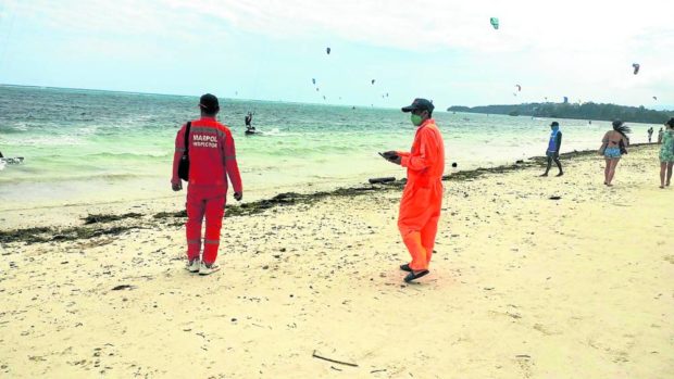
ON ALERT | Philippine Coast Guard personnel are on guard in the resort island of Boracay for any sign of the oil spill which has spread from Naujan, Oriental Mindoro, to Caluya, Antique. (Photo from the Facebook page of the Philippine Coast Guardd)
MANILA, Philippines — The Department of Environment and Natural Resources (DENR), along with the University of the Philippines Marine Science Institute (UPMSI), have begun disaster forensics of the oil spill from the tanker MT Princess Empress that sunk off Naujan, Mindoro, on Feb. 28.
Marine scientists continued to monitor the oil spill, which produced a slick initially estimated to be 25 kilometers long and 300 to 500 meters wide, but there were no reports of oil spills found on the coasts of Marinduque, east of Mindoro, and Romblon, in the southeast, as of Sunday.
However, there was also no word from the Philippine Coast Guard whether the sunken tanker had already been found to determine whether it was still spewing the 800,000 liters of oil it was carrying when it sunk on the morning of Feb. 28.
According to oil spill trajectory models, the UPMSI feared for the 36,000 hectares of coral reefs in Bulalacao, Oriental Mindoro, and Caluya, Antique, that could be affected by the spill.
On Saturday, oil was found in one of the islands of Caluya, Antique, which is in the Tablas Strait separating Mindoro, the Romblon islands, and Panay, only 18 nautical miles from the tourist island of Boracay in Aklan. But the PCG in the Western Visayas region noted that there were no indications of an oil spill in Boracay as of Sunday.
Article continues after this advertisementThe spill has so far moved in a southern direction, then southwest to Caluya, and possibly west to the Cuyo islands in Palawan.
Article continues after this advertisementHowever, the spill has already affected many towns in the eastern seaboard of Mindoro facing the Tablas Strait and marine scientists were concerned over the potential effect on hectares of coral reefs in Bulalacao and Caluya.
In separate bulletins issued over the weekend, UPMSI estimates that over 20,000 hectares of coral reefs, 9,900 of mangroves, and 6,000 hectares of seagrass may be affected.
Of this, at least 11,000 hectares are found in the Cuyo Islands, less than 60 nautical miles from the Caluya Islands.
Protected reefs
Critical are the protected reefs in Bulalacao, which cover 1,100 hectares; as well as the seagrass beds in the coastal barangays of Pola, Mansalay, and Bulalacao.
The Caluya Islands, which have a high possibility of being affected based on the oil spill trajectory model, also have significant areas of coral reefs (2,900 hectares), mangroves (350 hectares), and seagrass meadows (850 hectares), they said.
Environment Undersecretary Jonas Leones and the DENR Task Force MT Princess Empress, led by Undersecretary Malu Erni, arrived in Calapan, Oriental Mindoro, on Sunday to confer with local officials on a plan of action.
The undersecretaries said the DENR was coordinating the Department of Social Welfare and Development, Department of the Interior and Local Government, and Department of Labor and Employment to finalize arrangements for aid to local communities.
Serious impact on fishing
Oceana, an ocean conservation group, aquatic pollution could have a serious impact on fishing which would affect food prices.
Aquatic pollution is punishable under several laws, including the Fisheries Code (Republic Act No. 8550 as amended by RA 10654), Clean Water Act (RA 9275), and the Oil Pollution Law (RA 9483) and Oceania urged local governments to file charges against the vessel owner.
Philippine laws impose fines ranging from P600,000 to P1 million, and P30,000 per day; imprisonment of six years and one day to 12 years. The administrative fine is only half of the criminal fines.