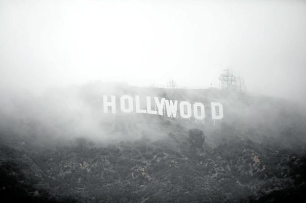
NO SPECIAL EFFECTS HERE The Hollywood sign is seen through a mix of fog and dust snow during a rare cold winter storm in the Los Angeles area on Feb. 24. —REUTERS
LOS ANGELES — A slow-moving winter storm intensified over California on Friday, triggering the first blizzard warning in parts of the Los Angeles area since 1989 and creating the extraordinary sight of snowflakes swirling around the iconic Hollywood sign.
Snow and rain pushed into the Pacific Coast state from the north, as the storm was expected to linger through Saturday, the National Weather Service (NWS) said.
A massive low-pressure system driven from the Arctic was responsible for the unusual conditions, said Bryan Jackson, a forecaster at the weather service’s Weather Prediction Center.
He described the phenomenon as “a rare case of a cold, significant storm event.”
NWS also reported on Friday that “Areas very close to the Pacific Coast and also into the interior valleys that are not accustomed to seeing snow may see some accumulating snowfall.”
Iconic sign
Elsewhere in the state, breathless television weather presenters more used to delivering a same-every-day forecast of warm sunshine found themselves knee-deep in snow.
And in a sight that must have delighted many in Los Angeles, snowflakes even fell around the iconic Hollywood sign atop Mount Lee, some 457.2 meters (1,500 feet) above the city—with its giant, white-block lettering visible for miles around.
British actor Craig Robert Young, who lives in Hollywood Hills within eyeshot of the famed sign, said he was amazed to see snow swirling there.
“I moved here from the UK 20 years ago, and haven’t seen snow since,” said the 46-year-old star of CW Network’s fantasy show “Charmed” and TNT’s “The Last Ship.”
Putting a name to it
Even before the latest storm in California, much of the state was already experiencing an unusually rainy winter.
Social media platforms were inundated with pictures of snow in gardens in higher elevation areas, as residents marveled at the weather.
NWS offered a Twitter tutorial for Californians struggling to put a name to this phenomenon spoiling the view of palm trees.
“Wondering what kind of frozen precipitation is falling from the sky in your area? Here is an informative graphic… that distinguishes between graupel and hail,” the tweet said.
The weather service described hail as “hard & solid” and defined it as “frozen raindrops of ice from thunderstorms,” while graupel was “soft & wet” and was defined as “snowflakes that collect supercooled water droplets on the outer surface.”
But the weather was reported to be near critical in other parts of the state.
Major roads were closed as ice and snow made them impassable, including sections of Interstate 5, the main north-south highway that connects Mexico, California, the Pacific Northwest, and Canada.