LPA off Davao City dissipates; no tropical cyclone expected until weekend — Pagasa
Source: DOST / Pagasa
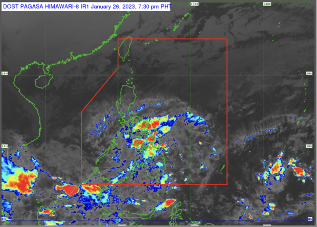
MANILA, Philippines — The low-pressure area off Davao City disappeared Thursday, expecting no tropical cyclones to enter or form within the Philippine Area of Responsibility until the weekend, the state weather bureau said.
The said LPA dissipated at 2 p.m., according to Raymond Ordinario, weather specialist of the Philippine Atmospheric, Geophysical and Astronomical Services Administration (Pagasa).
Ordinario added that no tropical cyclones are expected to form within the country’s area of responsibility for the next three days.
Friday weather
Despite the dissipation of the LPA, several areas in the country are still expected to have overcast skies with rains due to northeast monsoon or amihan and shear line.
Shear line, or the weather system forming when cold and warm winds converge, will bring cloudy skies with scattered rain showers and thunderstorms to Caraga region, Northern Mindanao, Eastern Visayas, Central Visayas, Albay, Sorsogon, and Catanduanes.
Article continues after this advertisementCloudy skies with rains are expected in Cagayan Valley, Cordillera Administrative Region, the rest of Bicol Region, Aurora, Quezon, Oriental Mindoro, Marinduque, and Romblon due to amihan, or the weather system caused by cold winds blowing from Siberia.
Article continues after this advertisementMetro Manila and the rest of the country are set to have fair weather, partly cloudy to cloudy skies with light rains and isolated rain showers or thunderstorms.
Gale warning
Meanwhile, Pagasa raised a gale warning due to amihan.
The seaboards of the following areas are set to have rough to very rough sea conditions with 2.8 to 5.5 meters of waves: Batanes, Babuyan Islands, Cagayan, Isabela, Aurora, Quezon Including Polillo Islands, Camarines Norte, Camarines Sur, Catanduanes, Albay, Sorsogon, And Masbate, Northern Samar, Eastern Samar, Samar, Biliran, Southern Leyte, Leyte, Bohol, Cebu, Dinagat Islands, Surigao Del Sur, Surigao Del Norte, Agusan Del Norte, Camiguin, Misamis Oriental, Misamis Occidental, and the northern coast of Lanao Del Norte.
A rough to very rough sea condition will bring 2.8 -5.0 meters of waves in the following areas: Negros Oriental, Siquijor, Negros Occidental, Guimaras, Iloilo, Capiz, Aklan, and Antique.
These areas will see a rough to very rough sea condition with 2.8 – 4.5 meters of waves: Ilocos Norte, Ilocos Sur, La Union, Pangasinan, Zambales, Bataan, Marinduque, Romblon, Oriental Mindoro, Occidental Mindoro, Batangas, Cavite, And Palawan including Kalayaan Islands.
RELATED STORY:
Pagasa: Rainy Monday in parts of PH due to LPA, ‘amihan’