Rosal winds down as it drifts away from PH

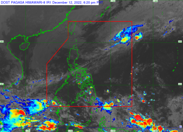
Weather satellite image from Pagasa’s website
MANILA, Philippines — Tropical Storm Rosal (international name: Pakhar) slightly weakened on Monday afternoon as it continued to pass over the Philippine Sea and move away from the country’s landmass, the state weather service said.
According to weather specialist Veronica Torres, the tropical depression was last spotted 880 kilometers east-west of extreme Northern Luzon. Rosal was packing maximum sustained winds of 75 kilometers per hour (kph) near the center and gustiness of up to 90 kph.
The latest weather bulletin of the Philippine Atmospheric Geophysical and Astronomical Services Administration (Pagasa) indicated that Rosal was still moving northeastward at 15 kph and seen to weaken into a low-pressure area by Tuesday.
But in the next 24 hours, as Rosal enhances the northeast monsoon (locally known as amihan), occasional gusts reaching gale force may be experienced over Batanes while a strong breeze to near-gale strength winds may be experienced over Babuyan Islands, and the coastal and upland areas of Ilocos Norte, northern and eastern Cagayan, and eastern Isabela.
For this, a gale warning is still raised over the seaboards of Batanes, Cagayan, Isabela, Babuyan Islands, locos Norte, Ilocos Sur, La Union, and Pangasinan.
Article continues after this advertisementDuring Pagasa’s briefing on the typhoon, Torres said the tropical storm is no longer expected to bring heavy rains to the country throughout its remaining forecast period.
The northeast monsoon. nevertheless, will bring cloudy skies and rain over Batanes, Cagayan, Babuyan Islands, and Apayao.
“Sa Metro Manila at nalalabang bahagi ng bansa, asahan ang magandang panahon maliban na lang sa isolated rain showers or thunderstorms,” said Torres.
(In Metro Manila and other parts of the country, expect good weather except for isolated rain showers or thunderstorms.)
RELATED STORY
Tropical Storm Rosal holds strength; ‘less likely’ to directly bring rain in PH – Pagasa