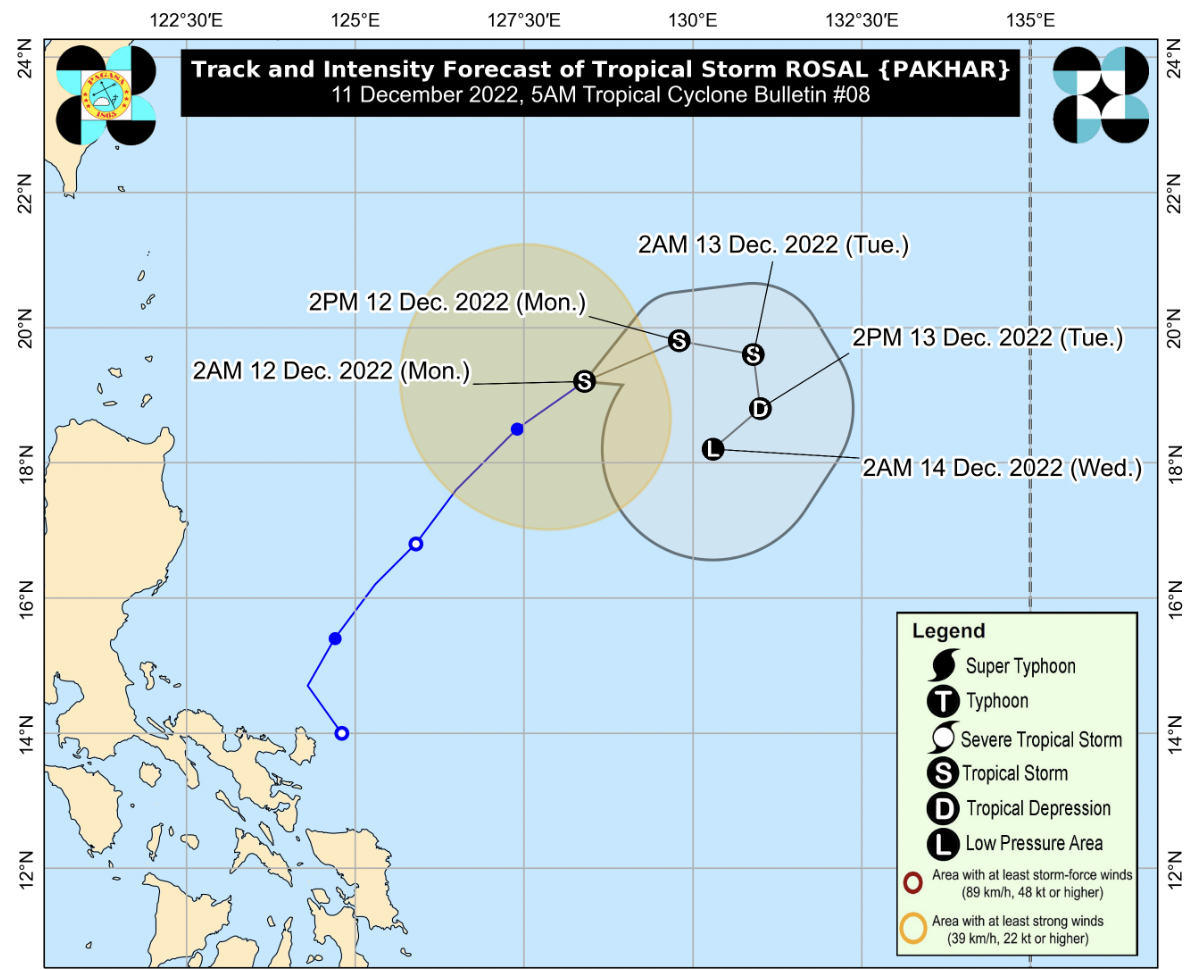
MANILA, Philippines — Tropical Storm Rosal (international name: Pakhar) further intensified on Monday while moving northeastward away from the country, the Philippine Atmospheric, Geophysical, and Astronomical Services Administration (Pagasa) said in its 5 a.m. bulletin.
As of 4 a.m., the center of Rosal was estimated to be 770 km East of Calayan, Cagayan. It has maximum sustained winds of 85 km/h near the center, gustiness of up to 105 km/h, and a central pressure of 994 hPa and moving northeastward at 20 km/h.
“Rosal is less likely to directly bring heavy rains (which may trigger flooding or rain-induced landslides) in the country throughout the forecast period,” Pagasa said as it no longer raised any tropical cyclone wind signals.
In the next 24 hours, the surge of the Northeast Monsoon partly enhanced by Rosal may bring occasional gusts reaching gale-force and strong breeze in the following areas:
- Batanes
- Babuyan Islands
- Coastal and upland areas of Ilocos Norte
- Northern and eastern Cagayan
- Eastern Isabela
The effect of the surge of the Northeast Monsoon plus the tropical cyclone may also bring moderate to rough seas over the seaboards of Central Luzon and the eastern and western seaboards of Southern Luzon.
Pagasa also issued a gale warning due to the surge of the northeast monsoon and Rosal in the following seaboards in Northern Luzon: Batanes, Ilocos Norte, Ilocos Sur, La Union, Pangasinan, Cagayan including Babuyan Islands, and Isabela.
“Fishing boards and other small seacraft are advised not to venture out into the sea while larger sea vessels are alerted against big waves,” the weather bureau said.
Pagasa said Rosal is expected to move generally northeastward until Monday afternoon before turning eastward for the remainder of the day. During this same period, this tropical storm is expected to maintain its present intensity, although a short window of slight intensification is not ruled out, which may potentially bring it to the severe tropical storm category within the day.
By Tuesday, Rosal will begin encountering increasingly unfavorable conditions due to the surge of the Northeast Monsoon which may result in rapid weakening and a southward to southwestward turn in its direction.
“Rosal is forecast to become a remnant low tomorrow (Tuesday) evening or on Wednesday early morning before dissipating shortly thereafter,” the weather bureau said.
READ: 40 passengers stranded in Bicol ports