
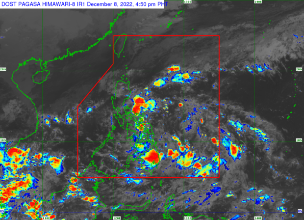
This photo is a weather satellite image from the website of the Philippine Atmospheric, Geophysical and Astronomical Services Administration (Pagasa. – A low pressure area enters the Philippine area of responsibility on Thursday, December 8, 2022, according to the 4 p.m. weather advisory of Pagasa.
MANILA, Philippines — A low-pressure area (LPA) entered the Philippine area of responsibility (PAR) on Thursday, according to the Philippine Atmospheric, Geophysical and Astronomical Services Administration (Pagasa).
Based on Pagasa’s 4 p.m. weather advisory, the LPA was last spotted 870 kilometers east of Mindanao.
“Ang nasabing low-pressure area nating binabantayan, dahil nagpapakita ito, base sa analysis, ng mga posibilidad na maging bagyo sa susunod na mga araw,” Pagasa weather specialist Raymond Ordinario said during the agency’s 5 p.m. weather bulletin broadcast.
(The low-pressure area that we are monitoring because it shows, based on analysis, possibilities of becoming a storm in the following days).
The state weather service noted that the LPA’s trough would trigger cloudy skies with scattered rain and thunderstorms in Mindanao, Eastern Visayas, Central Visayas, and Bicol Region.
Pagasa also said the shear line would bring overcast skies and rain in Cagayan, Apayao, and Ilocos Norte.
Further, the bureau announced that a gale warning was raised in Batanes, Cagayan, Babuyan Islands. Ilocos Norte, Ilocos Sur, La Union, and Pangasinan due to the northeast monsoon, which is locally termed as amihan. Pagasa urged fisherfolk and sailors in these areas not to go out to sea due to expected large waves.
RELATED STORIES
Pagasa: LPA nears Mindanao, E. Visayas; rain showers expected
Pagasa: 1 to 2 storms expected in December