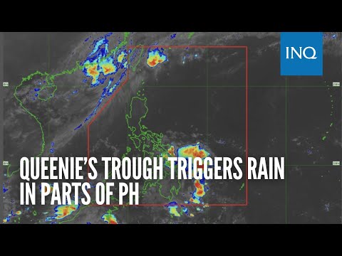
MANILA, Philippines – The trough of a low pressure area (LPA), which was formerly known as Tropical Depression Queenie, is triggering rain in parts of the country on Wednesday, said the state weather bureau.
According to the Philippine Atmospheric, Geophysical and Astronomical Services Administration (Pagasa), there are cloudy skies with scattered rain and thunderstorms in Eastern Visayas, Caraga and Davao Region.
“Ito po yung Bagyong Queenie, na humina na at nalusaw at ngayo’y isang low pressure area na, nakaka-apekto na nga dito sa eastern Visayas, Caraga, at Davao,” said Pagasa weather specialist Obet Badrina.
(This Tropical Depression Queenie, that weakened, dissipated and is now a low pressure area, is affecting eastern Visayas, Caraga and Davao).
The LPA is currently 355 kilometers east southeast of Hinatuan, Surigao del Sur, said Pagasa. Pagasa warned the aforementioned areas of possible landslides and floods due to the rains.
While former Severe Tropical Storm Paeng (international name: Nalgae) has left the Philippine area of responsibility, Pagasa still raised a gale warning over the seaboards of northern Luzon, and the western seaboards of central and southern Luzon due to strong winds.
Meanwhile, fair weather with chances of isolated rainshowers is expected to prevail in Metro Manila and the rest of the country, said Pagasa.
Here are the temperature ranges for Wednesday, according to Pagasa:
- Metro Manila — 24 to 32 degrees Celsius
- Baguio — 16 to 22 degrees Celsius
- Laoag — 24 to 32 degrees Celsius
- Tuguegarao — 25 to 32 degrees Celsius
- Legazpi — 25 to 32 degrees Celsius
- Puerto Princesa — 24 to 32 degrees Celsius
- Tagaytay — 21 to 31 degrees Celsius
- Kalayaan Islands — 24 to 32 degrees Celsius
- Iloilo — 25 to 32 degrees Celsius
- Cebu — 25 to 32 degrees Celsius
- Tacloban — 26 to 31 degrees Celsius
- Cagayan de Oro — 24 to 32 degrees Celsius
- Zamboanga — 25 to 33 degrees Celsius
- Davao — 25 to 33 degrees Celsius